|
|
|
|
|
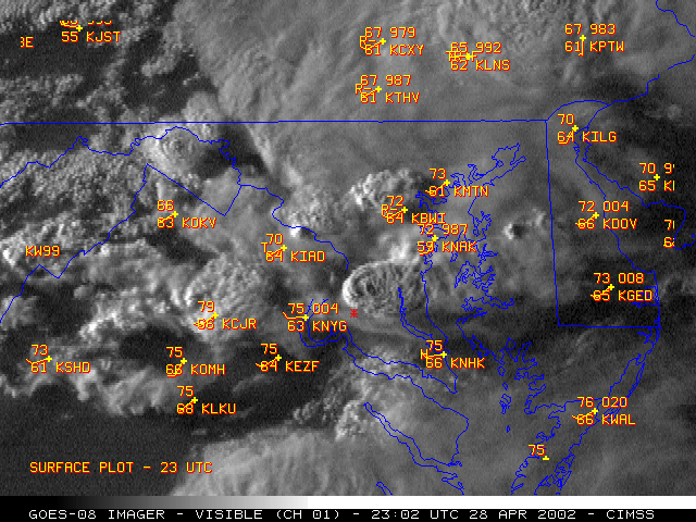
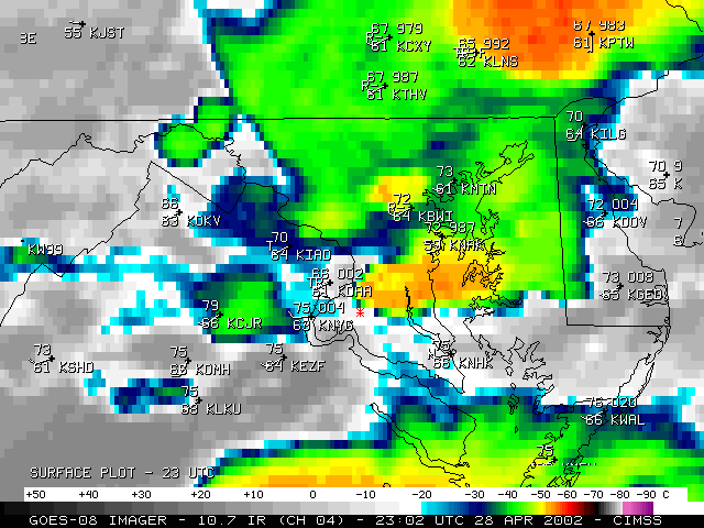
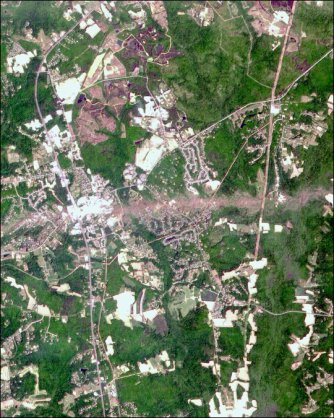
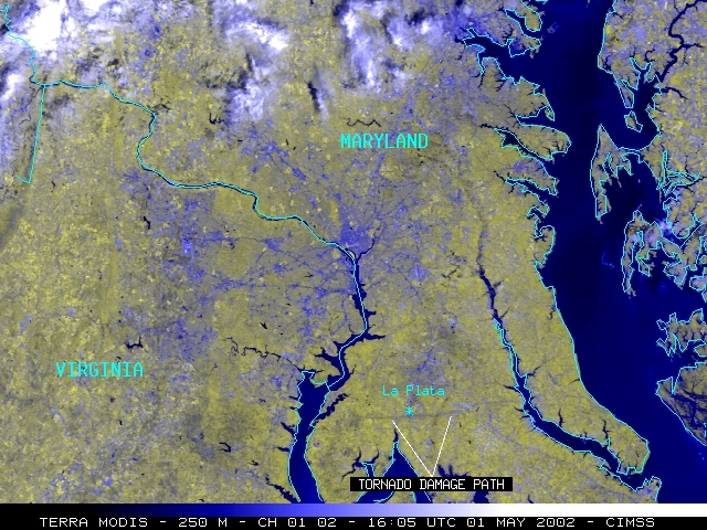
A tornado struck La Plata, Maryland on 28 April 2002, producing F4 damage. The imagery above from NOAA GOES-8 was available at 5-10 minute intervals during this event, since the satellite was placed into Rapid Scan Operations (RSO) mode earlier in the day. An "Enhanced-V" cloud top signature was evident with the La Plata storm on the IR data, but not until 23:10 UTC (after the supercell became tornadic). The damage path of the tornado is visible in this NASA EO-1 Advanced Land Imager (ALI) image as well as this Terra MODIS image. The storm was producing multiple tornadoes as it crossed Chesapeake Bay.
|
|
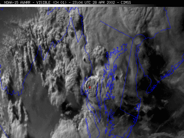
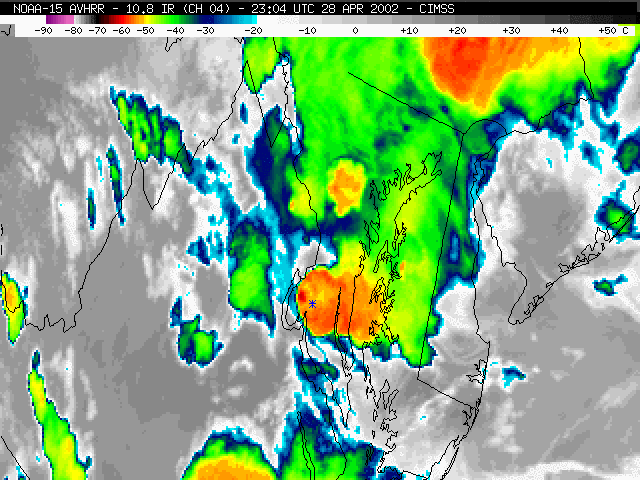
 (- Fade between NOAA-15 visible and IR images at 23:04 UTC -)
A timely overpass of the NOAA-15 polar-orbiting satellite at 23:04 UTC (7:04 PM Eastern time) showed the storm top structure as it was producing the La Plata tornado. The higher spatial resolution of the AVHRR-3 IR data (1 km, compared to 4 km for GOES) showed the early stages of the formation of an "Enhanced-V" cloud top signature at that time.

