|
|
|
|
|
|
|
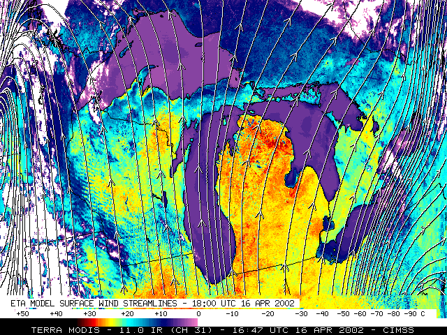
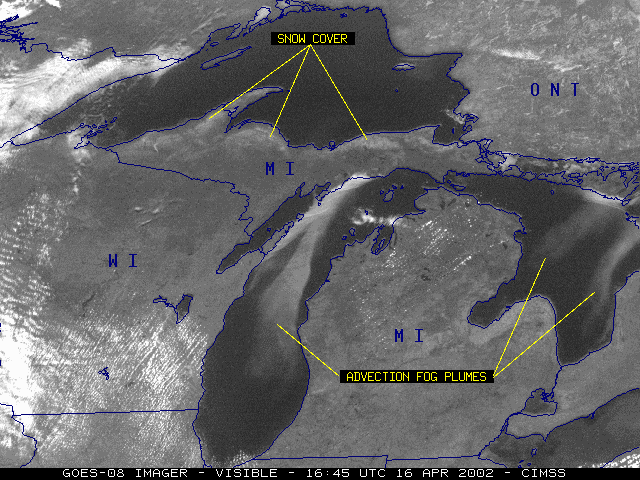
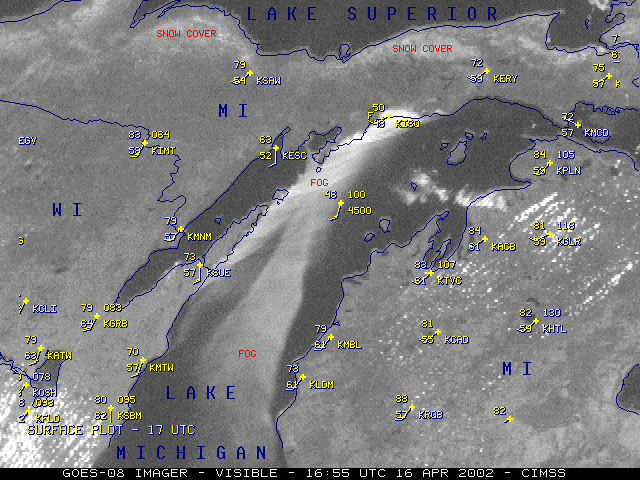
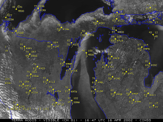
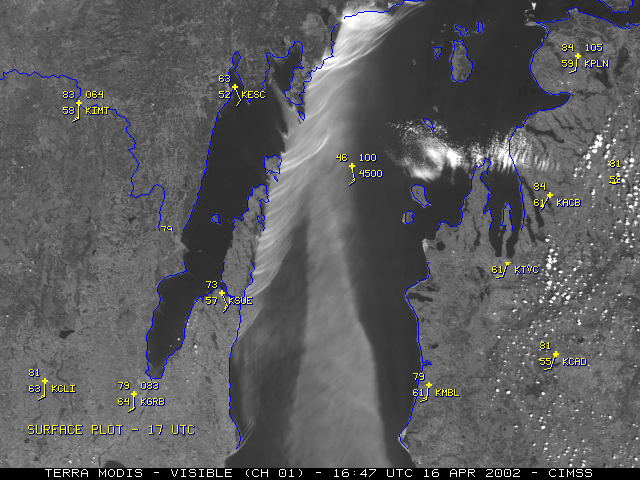
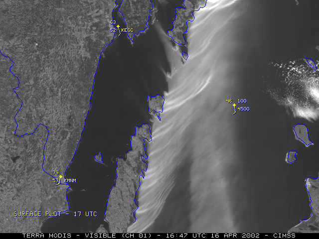
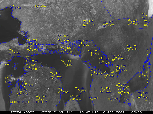
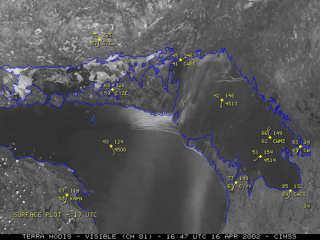
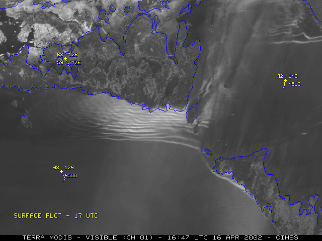
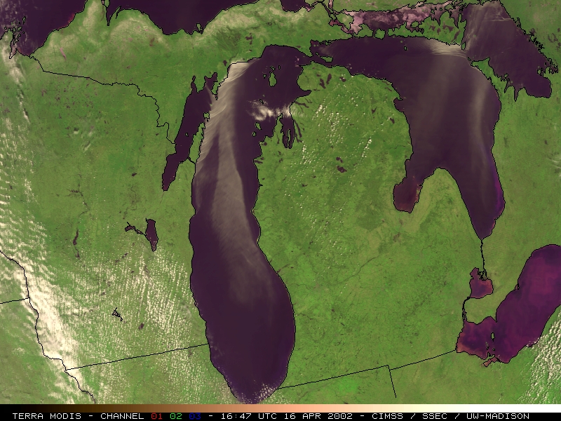
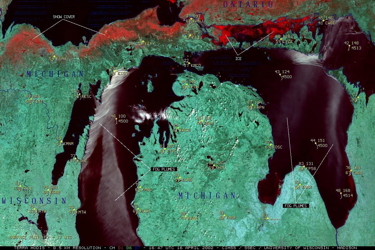
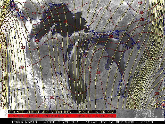
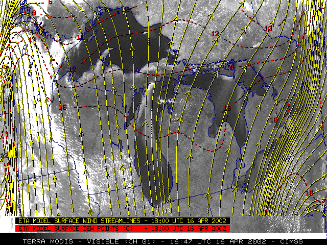
Southerly flow of unseasonably warm, moist air (temperatures of +20 to +26 C, dew points of +14 to +16 C) over the relatively cool (generally +2 to +5 C) water of Lake Michigan and Lake Huron contributed to the development of large advection fog plumes during the day on 16 April 2002. As these fog plumes moved northward during the day, the flow eventually interacted with various coastal features to produce both attached and detached shock wave clouds upwind of the rugged coastline of Wisconsin, the Upper Peninsula of Michigan, and Ontario. These internal gravity waves remained trapped within the strong marine layer temperature inversion which was sustained by the continued flow of warm air across the cool water surface.
|
|
|
|
|
|
|
|
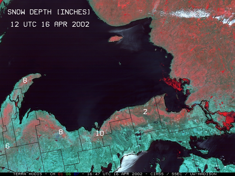
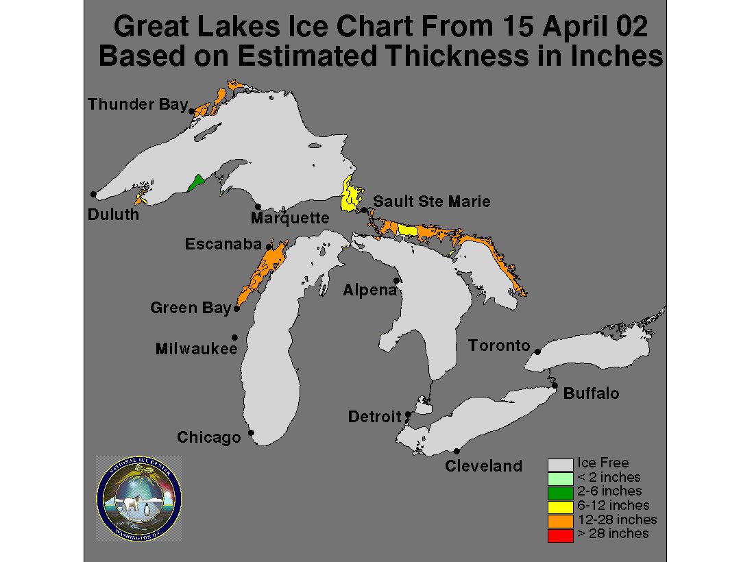
March 2002 was abnormally cold and snowy across the Upper Peninsula of Michigan, and significant snow cover (red enhancement on the MODIS channel 1/6/7 composite image) remained over much of that region (and Ontario, Canada) on the morning of 16 April. In addition, a majority of the North Channel portion of Lake Huron was still thick pack ice. The unseasonably warm temperatures were causing the remaining snow pack to melt quickly, leading to flooding problems across parts of the Upper Peninsula.
References:
The Dynamics of Wave Clouds Upwind of Coastal Orography, Burk, S.D. and T. Haack, M. Wea. Rev., 128, 1438-1455, 2000.
Address any questions or comments to the GOES WebMasters

