|

|
|
|
|
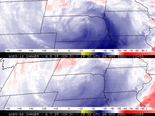
Comparisons of "water vapor" channel imagery from the NOAA GOES-12 and GOES-08 satellites show the improved spatial resolution of the GOES-12 water vapor data (4 km in both the N-S and W-E directions). In this example, a deep cyclone was intensifying over Nebraska on 26 November 2001, producing a mixture of winter precipitation across parts of the northern plains states. A mesoscale mid/upper level jet streak is more clearly depicted on the GOES-12 water vapor channel imagery, moving northward across Kansas and Nebraska into extreme southern South Dakota (along the eastern periphery of the developing cyclone). This jet streak appears to have aided in the development of 2 west-east oriented cloud bands that produced moderate to heavy snowfall (on either side of the eastern segment of the Nebraska/South Dakota border). The snowfall was convectively-enhanced in the southernmost band (across extreme northeastern Nebraska) after about 21:00 UTC on 26 November.

