|
|
|
|
|
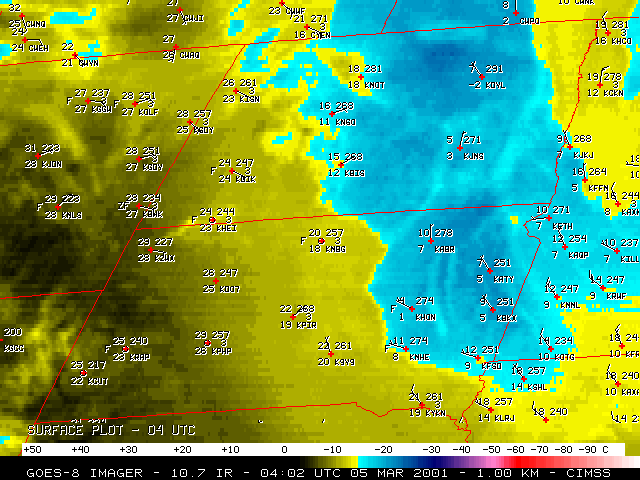
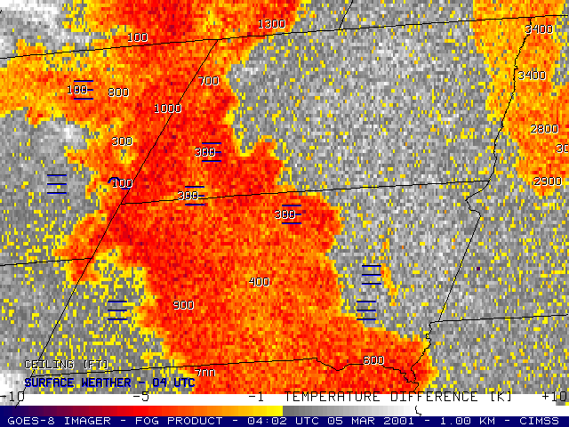
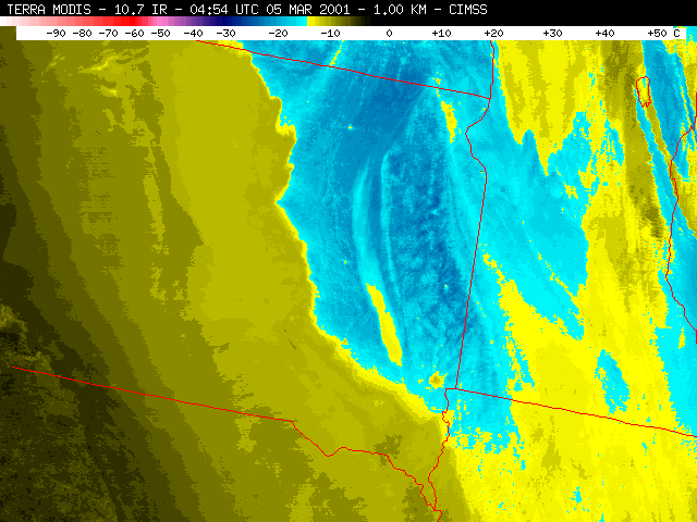
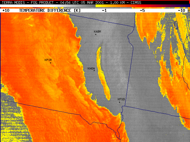
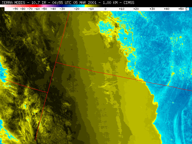
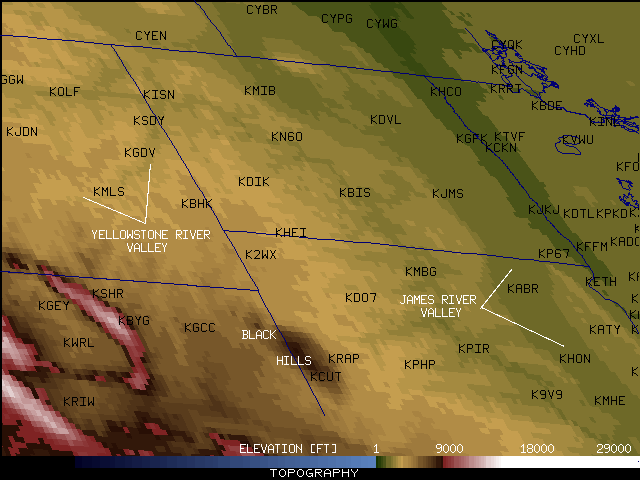
NOAA GOES-8 10.7 micrometer longwave InfraRed (IR) imagery (above, left) and fog/stratus product imagery (above, right) showed 2 large areas of fog/stratus across the northern Plains region during the overnight hours on 05 March 2001. One large area of upslope-generated fog/stratus (yellow to red enhancement) was nearly stationary across much of central South Dakota, southwestern North Dakota, and northeastern Montana, while a second area of elevated stratus was moving westward across Minnesota into eastern North Dakota and extreme northeastern South Dakota. There is also evidence of fog developing in the James River valley region of east-central South Dakota (near Huron SD, KHON).
Portions of central/eastern North Dakota and eastern South Dakota which were not covered by the fog/stratus were experiencing strong radiative cooling due to the extensive snow pack (10-34 inches) and light winds, and surface temperatures were dropping into the single digits F (-13 to -17 C). Regions beneath the fog/stratus reported warmer surface temperatures, from the middle teens F to the middle 20s F (-3 to -8 C). The tops of the fog/stratus were actually warmer (-10 to -14 C, yellow enhancement on the 10.7um IR) than the adjacent clear sky regions where radiational cooling was prevalent (-15 to -20 C, light blue enhancement on the 10.7um IR), a phenomenon known as "black stratus".
|
|
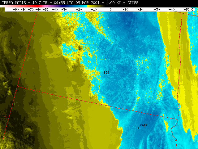
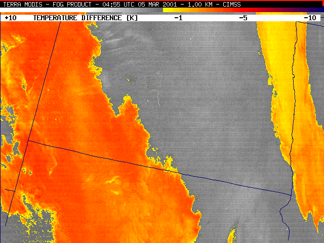
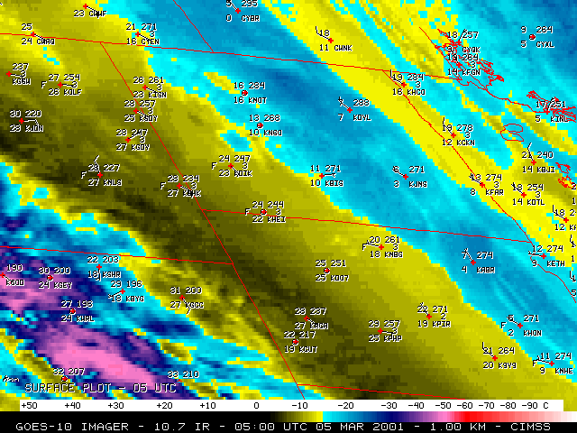
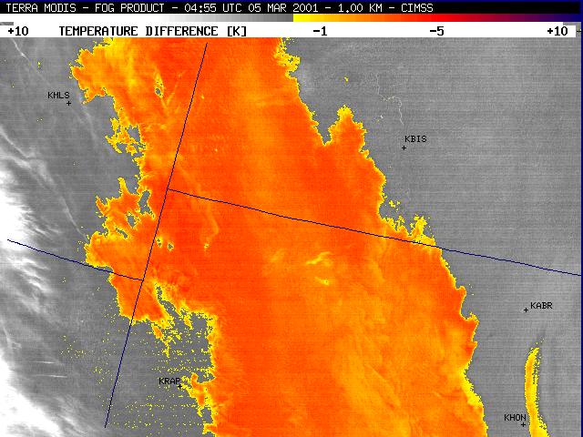
Longwave IR and fog/stratus product imagery from the Terra MODIS instrument (above, and below) showed greater detail in the structure of the 2 main fog/stratus features (using the same enhancements as the GOES-8 imagery shown at the top of the page). A narrow area of fog/stratus was in the process of developing within the James River valley region of east-central South Dakota (note the surface reports of fog [F] and freezing fog [ZF] at Huron, SD, KHON), and this elongated feature was detected very well by the MODIS fog/stratus product (below). Though there was an indication of this James River valley fog feature on the GOES-8 fog/stratus product, the feature had better definition on the MODIS imagery.
|
|
|
|
 (- Fade between GOES-10 IR and fog/stratus product images -)
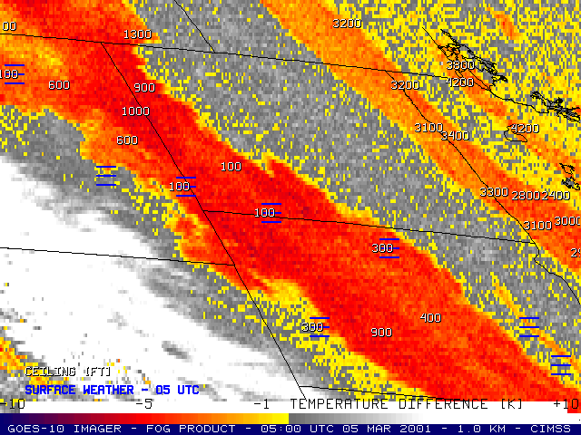
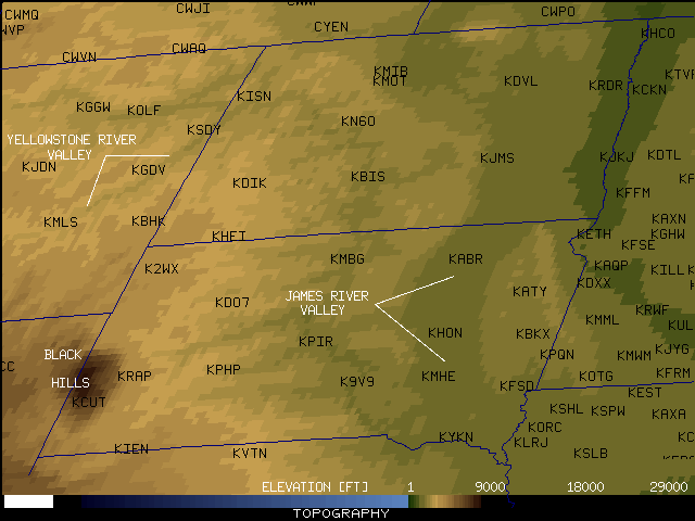
GOES-10 imagery (above) and MODIS imagery (below) showed that the western edge of the thick fog/stratus was advancing southwestward down the Yellowstone River valley toward Miles City, Montana [KMLS], and also southwestward toward Rapid City, South Dakota [KRAP]. Freezing fog (ZF) was reported at both Miles City MT and Rapid City SD after 07 UTC, with visibility dropping to below 1 mile.
|
|


![Miles City, Montana [KMLS]](010305_KMLS_MG.GIF)
![Rapid City, South Dakota [KRAP]](010305_KRAP_MG.GIF)