
|
|
|
|
|
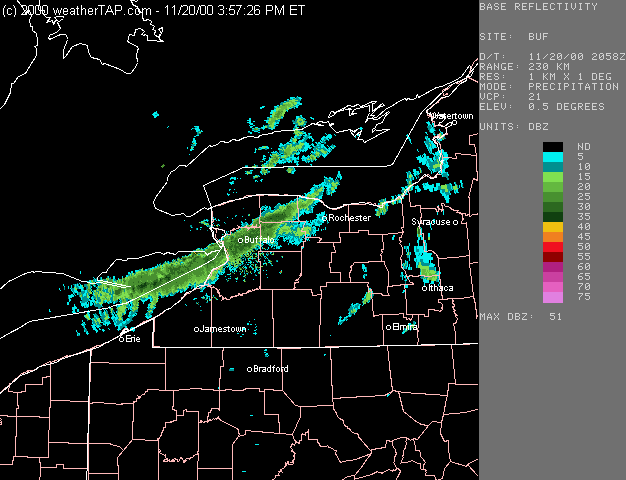
One of the most intense lake-effect snow storms for so early in the season gave Buffalo NY 24.8 inches of snow on 20 November 2000 -- a record accumulation for any November snow event. Snowfall rates up to 3 inches per hour were observed, along with thunder and lightning. NOAA GOES-8 visible imagery (above, left) shows the formation of the well defined single-band lake effect feature during the day, as a long fetch of cold southwesterly flow persisted over the warm water of Lake Erie. Radar reflectivity from Buffalo (above, right) shows that the snowfall from this band extended well inland across New York state [NIDS data provided by WeatherTap].

