|

|
|
|
|
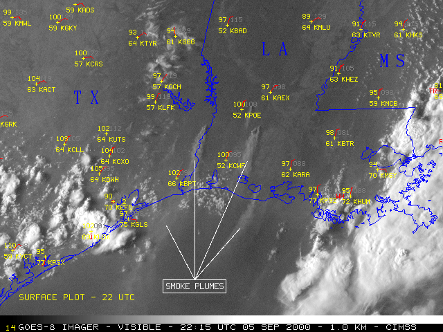
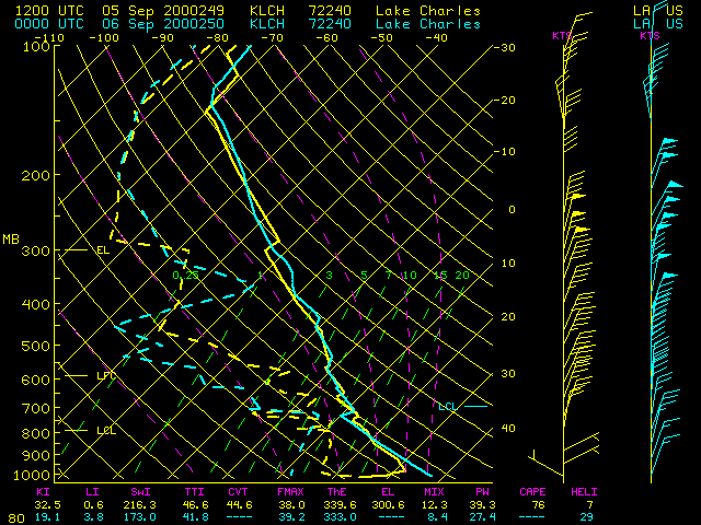
The southcentral U.S. experienced hot, dry weather for several days in early September 2000, creating a high fire danger. Record daily high temperatures on 05 September included 104 F at Lake Charles LA (KLCH), 104 F at Galveston TX (KGLS), and an all-time record high of 111 F at Victoria TX (KVCT). NOAA GOES-8 visible imagery (above, left) shows smoke plumes from fires burning over Louisiana and Texas. Rawinsonde data from Lake Charles, LA showed that a deep, dry adiabatic boundary layer had developed by 00 UTC (7 PM CDT), extending from the surface upward to the 728 mb level (2860 m above ground level). The north-northeasterly flow within this deep mixed layer was advecting the smoke south-southwestward over the Gulf of Mexico.
The experimental Wildfire Automated Biomass Burning Algorithm (ABBA) identified numerous fire pixels in GOES-8 imagery (above, right). Each image is an alpha-blended composite of GOES-8 multi-spectral imagery and a 1-km resolution global land cover characteristics ecosystem data base derived from 1-km Advanced Very High Resolution Radiometer (AVHRR) data. Saturated fires (brightness temperatures of 335 K or warmer, yellow pixels) were evident over southern Louisiana and extreme eastern Texas. These hot fires were producing the largest smoke plumes.


