Hold the left mouse button down as you drag the slider above the image (or use the arrow buttons) to fade between the GOES-8 visible channel and the corresponding GOES-8 10.7 micrometer IR image at 23:15 UTC on 25 July (6:15 PM CDT). To zoom, click on the "Zoom" button, and then click the "hand" cursor on the image where you want to center the zoom.
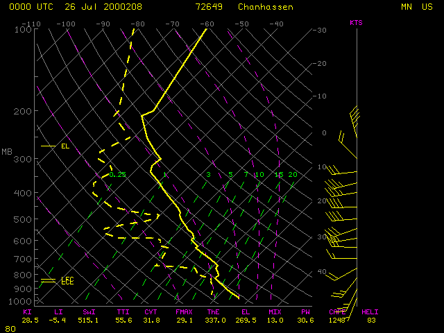
The tornado at Granite Falls (just southeast of Montevideo, identifier KMVE) occurred around 23:20 UTC. Note the appearance of shadowing and texture on the visible image over that region, indicating overshooting thunderstorm tops. On the IR image the coldest cloud top temperature near KMVE was -55 C (orange to red enhancement), near the temperature of the tropopause (-54.3 C) on the 00 UTC Minneapolis rawinsonde report.