|
|

 (- Fade between GOES-10 visible and IR images at 00:46 UTC -)
GOES-10 and GOES-8 imagery | NOAA-12 AVHRR imagery | GOES-11 imagery
|
|
|
(- Fade between GOES-10 visible and IR images at 00:46 UTC -)
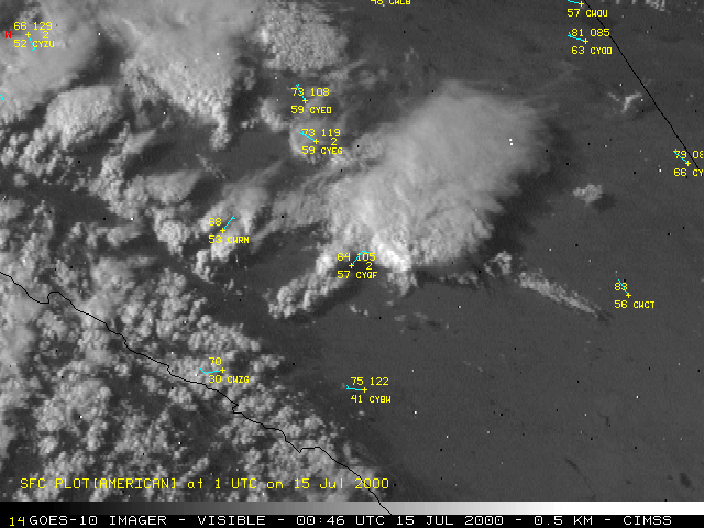
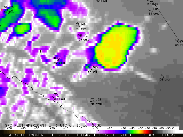
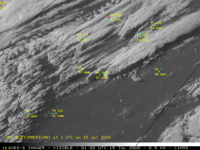
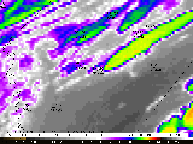
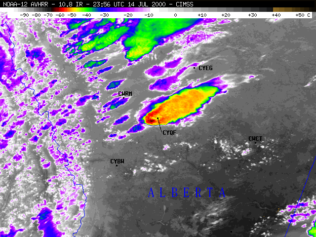
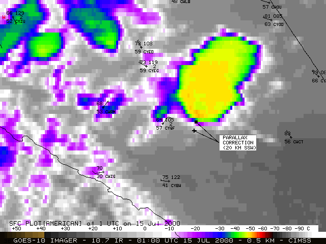
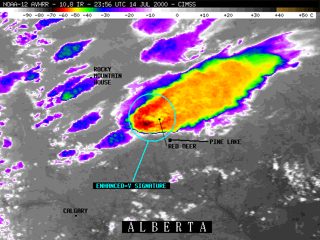
A tornado occurred at Pine Lake, Alberta (about 25 km southeast of Red Deer, station identifier CYQF), from 00:45 to 01:15 UTC on 15 July 2000 (6:45 to 7:15 PM MDT on 14 July). 12 fatalities and over 100 injuries resulted when the tornado struck the Green Acres lakeside trailer park and campground (producing F3 damage). This storm also produced golfball to baseball size hail.
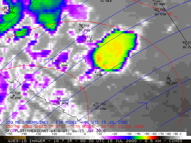
NOAA GOES-10 (above) and GOES-8 (below) visible and 10.7 micrometer InfraRed (IR) imagery shows the development of convection across southern Alberta (about 320 km north of the U.S./Canadian border). The storms formed over the foothills of the Rocky Mountains in western Alberta, then moved northeastward across the plains. At 23:11 UTC (5:11 PM MDT), the GOES-10 IR brightness temperature first became colder than -50 C (orange enhancement), which was approximately the temperature of the tropopause (-51.5 C at 228 mb) on the Edmonton, Alberta rawinsonde report. A few images later (23:30 UTC, about 75 minutes prior to the Pine Lake tornado), an "Enhanced-V" cloud top signature became evident, which often indicates convection that is producing or will soon produce damaging winds, large hail, or tornadoes.
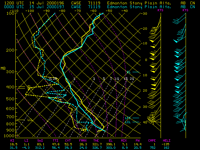
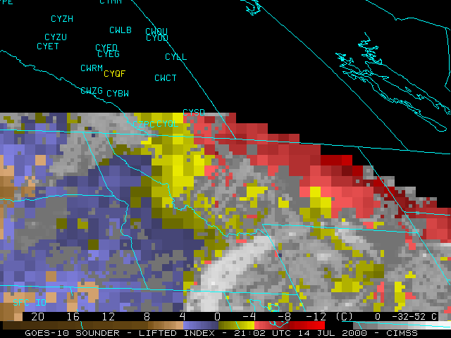
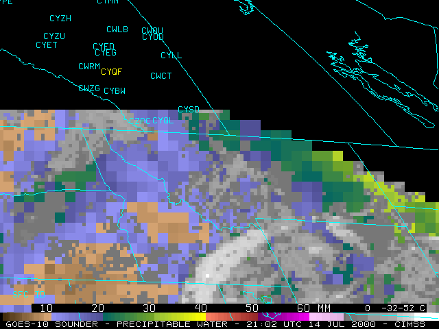
At 250 mb, a 50 m s-1 jet streak was approaching southern Alberta from the southwest, enhancing deep layer wind shear across the region. Surface observations suggested that an axis of higher moisture existed east of the developing convection -- the dewpoint just ahead of the storm at Red Deer (CYQF) was 61 F at 23:00 UTC, and the dewpoint at Coronation (CWCT) increased from 41 F at 23:00 UTC to 55 F at 00:00 UTC. Unfortunately, the coverage of the GOES-10 Sounder only extended northward to about 50 North latitude, preventing the ability to monitor hourly stability or moisture parameters in the pre-convective environment. The GOES-10 Sounder products did, however, hint that both an axis of instability and a moisture gradient were extending from eastern Montana (where a severe thunderstorm watch had been issued) northwestward into extreme southeastern Alberta and southwestern Saskatchewan.
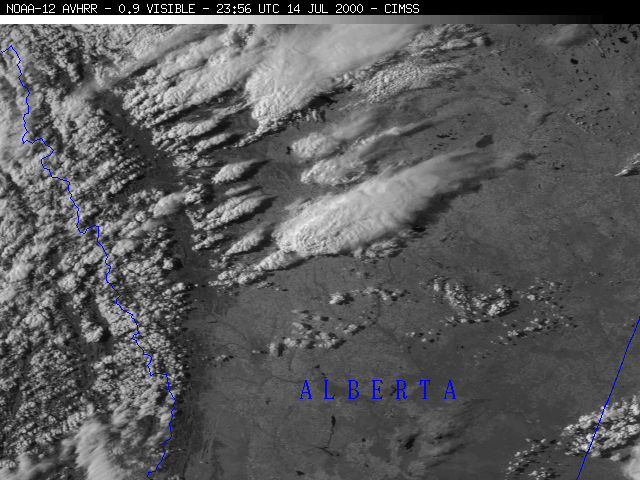
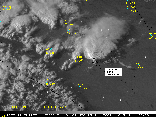
Due to the high latitude (52 North) and high tops (10-11 km above ground level) of these storms, a significant parallax correction is needed to correctly locate the satellite features on the ground. This places the southern edge of the main storm anvil region 20 km to the south-southwest (visible | IR), closer to the location of Pine Lake. The storms appear more elongated in the GOES-8 imagery because of the more extreme viewing angle of that satellite (GOES-8 is located over the Equator at 75 W longitude; GOES-10 is located at 130 W longitude). The noise (random black and white pixels) in the GOES-8 and GOES-10 visible imagery was the result of an ongoing solar radiation storm that was affecting satellite communications.
|
|
Visible and IR data from the 23:56 UTC (5:56 PM MDT) overpass of the NOAA-12 polar orbiting satellite are shown below. Note the finer detail in the cloud top temperature structure, due to the higher resolution of the NOAA-12 AVHRR/2 instrument (1 km, versus the GOES IR resolution of 4 km). The NOAA-12 IR data also indicated colder cloud top temperatures within the "Enhanced-V" signature [-66 C (dark red enhancement), compared to -51 C (orange enhancement) measured by GOES-10 at 23:53 UTC].
|
|
|
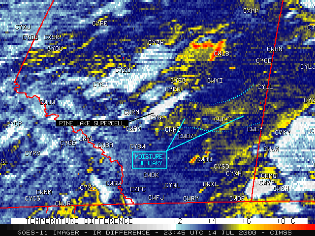
GOES-11 was launched in May 2000, and was undergoing a Science Test during July-August 2000 (which included continuous imaging at 5-minute intervals). The GOES-11 10.7-12.0 micrometer IR difference product (above) shows evidence of a west-east oriented region of higher boundary layer moisture, along a Red Deer (CYQF) to Coronation (CWCT) line during the hours leading up to the development of the supercell that produced the Pine Lake tornado. This IR difference product highlights regions where the GOES-11 12.0 micrometer brightness temperatures are 5-6 K cooler than the corresponding GOES-11 10.7 micrometer brightness temperatures, due to attenuation by moisture pooled within the boundary layer. The Pine Lake supercell began to move to the right of the environmental (southwesterly) flow, taking a more east-northeasterly path. The storms motion toward this region of increased boundary layer moisture may have played a role in the further intensification of the supercell prior to its producing large hail and the tornado.
 "A Satellite Perspective of the Pine Lake Alberta Tornado Event", 11th Conference on Satellite Meteorology and Oceanography, Madison, Wisconsin, 15-18 October 2001.
VISITview lesson demonstration, with self-contained instructor audio and annotations | README file
