This loop of GOES-11 visible channel imagery shows the development of severe convection along and ahead of a cold front moving southeastward across eastern South Dakota on 11 July 2000. Image intervals are every 5 minutes, during the period 20:34 to 00:07 UTC. In addition to the thunderstorm overshooting tops (indicating the most intense updraft regions), other items of interest on this animation include:
* cumulus development along a developing north-south warm front, located along a Huron (KHON) to Mitchell (KMHE) line at 20:25 UTC (the first image of the loop). At 22 UTC, the temperature/dewpoint west of the warm front at Mitchell (KMHE) was 93/63 F with southwesterly winds, while east of the front at Sioux Falls (KFSD) it was 81/72 F with southeasterly winds. This developing frontal boundary may have played a role in convective iniitation and intensification as it moved eastward into southeastern South Dakota.
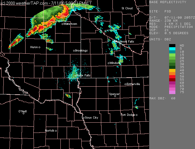
* banded low-level "wave clouds" across southeastern South Dakota into northwestern Iowa and southwestern Minnesota (evident during the middle and later portions of the loop). This is a signature of low-level warm air advection (from the west and southwest) over the pool of more stable low-level air located across southeastern South Dakota; these types of air mass boundaries can often act as a focus for convective development or intensification.
* two distinct pulses of low-level outflow cloudiness in the wake of the strong convection over northeastern South Dakota (between Aberdeen (KABR) and Watertown (KATY), later in the loop). Note that the wind at Watertown (KATY) switches back to southeasterly after 22 UTC, as a result of this thunderstorm outflow.
The first two boundaries can also be seen in an animation of radar reflectivity from the Sioux Falls WSR-88D (NIDS data courtesy of WeatherTap).