12 May 2000 | Los Alamos New Mexico Wildfires

GOES-8 3.9 IR image - Click to enlarge

GOES-8 3.9um IR image

(- Animation -)

GOES-8 visible image - Click to enlarge

GOES-8 visible image

(- Animation -)

Cool! (- Fade between GOES-8 IR and visible images -) Cool!

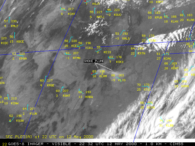
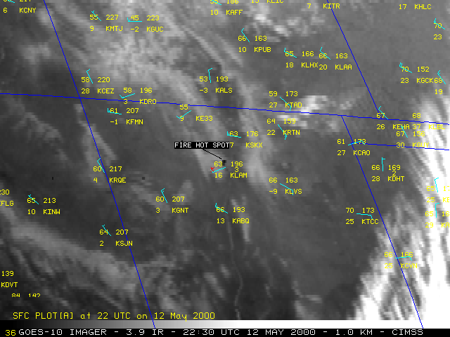
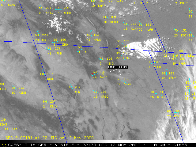
A prescribed burn near Bandelier National Monument in New Mexico on 04 May 2000 grew out of control and eventually spread into parts of Los Alamos several days later. These fires burned over 42,000 acres and forced the evacuation of Los Alamos and the Los Alamos Nuclear Laboratory. Visible and 3.9 micrometer shortwave InfraRed (IR) images from the NOAA GOES-8 (above) and GOES-10 (below) satellites show the "hot spots" (black pixels) and smoke plumes associate with these fires on 12 May.

GOES-10 3.9 IR image - Click to enlarge

GOES-10 3.9um IR image

(- Animation -)

GOES-10 visible image - Click to enlarge

GOES-10 visible image

(- Animation -)

Cool! (- Fade between GOES-10 IR and visible images -) Cool!


Address any questions or comments to the GOES WebMasters

Click here to go Back to the CIMSS GOES Gallery