|
|
|
|
|
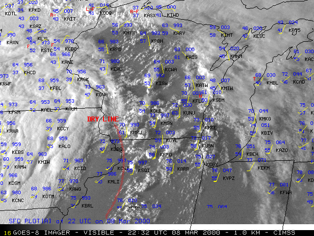
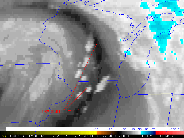
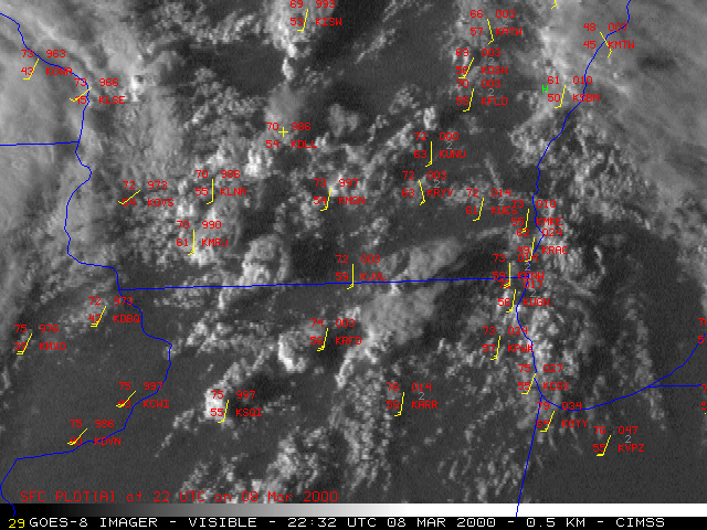
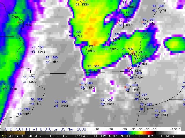
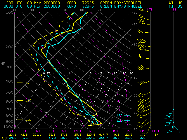
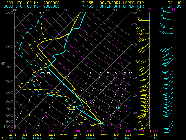
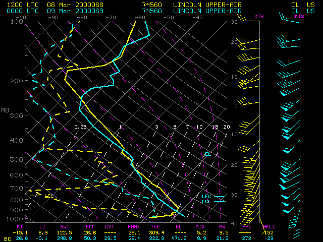
A short-lived F1 tornado late in the day on 08 March 2000 was the earliest tornado on record at Milwaukee, Wisconsin (the previous record was 02 April, 1977). NOAA GOES-8 visible and "water vapor" imagery (above) shows a surface dry line and a mid-level dry slot moving eastward across Wisconsin and Illinois during the afternoon and early evening hours. Rapid Scan Operations (RSO) was initiated for the GOES-8 satellite after 21:26 UTC, allowing imagery at 5 to 10 minute intervals during this event. Closer views with the RSO visible and InfraRed (IR) imagery (below) shows the convection developing along and east of the advancing dry line; IR cloud top temperatures reached -50 C and colder (yellow to orange enhancement), which corresponded to altitudes of at least 30,000 ft (9 km) on the Green Bay WI, Davenport IA, and Lincoln IL rawinsonde profiles. Large hail (up to 1.75 inches in diameter) was also reported across much of southern Wisconsin with this convection.
|
|
|

|
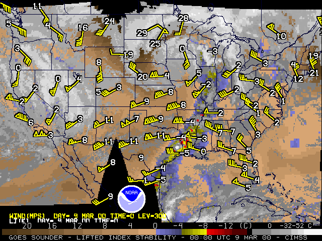
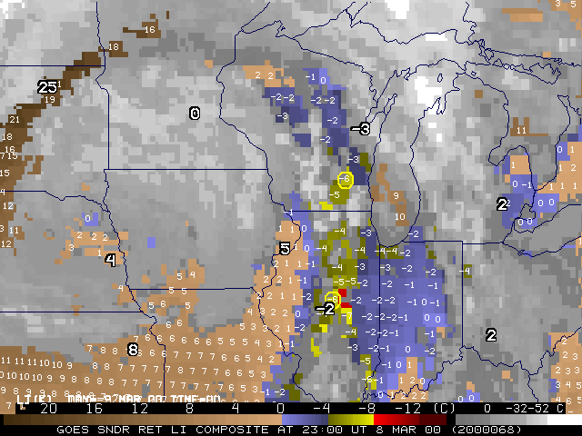
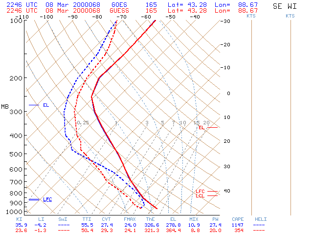
Derived products from the GOES-8 Sounder (above) show the elongated moist (Precipitable Water values of 20-30 mm) and unstable (Lifted Indices of -4 to -8 C) axis which extened from the Gulf of Mexico northward into the Great Lakes region. A closer view of the Lifted Index product (below left) shows LI's of -4 to -8 across central Illinois into southeastern Wisconsin at 23:00 UTC (near the time of the initial large hail reports across southern Wisconsin, and about an hour prior to the Milwaukee tornado). The temperature and moisture profile for the sounding retrieval point circled in southeastern Wisconsin (below, right) shows that the GOES Sounder made important corrections to the numerical model "first guess" moisture, adding moisture in the lower levels (within the moist axis ahead of the surface dry line) and subtracting moisture aloft (within the mid-level dry intrusion seen on water vapor imagery).
|
|
