Tropical Storm Florence
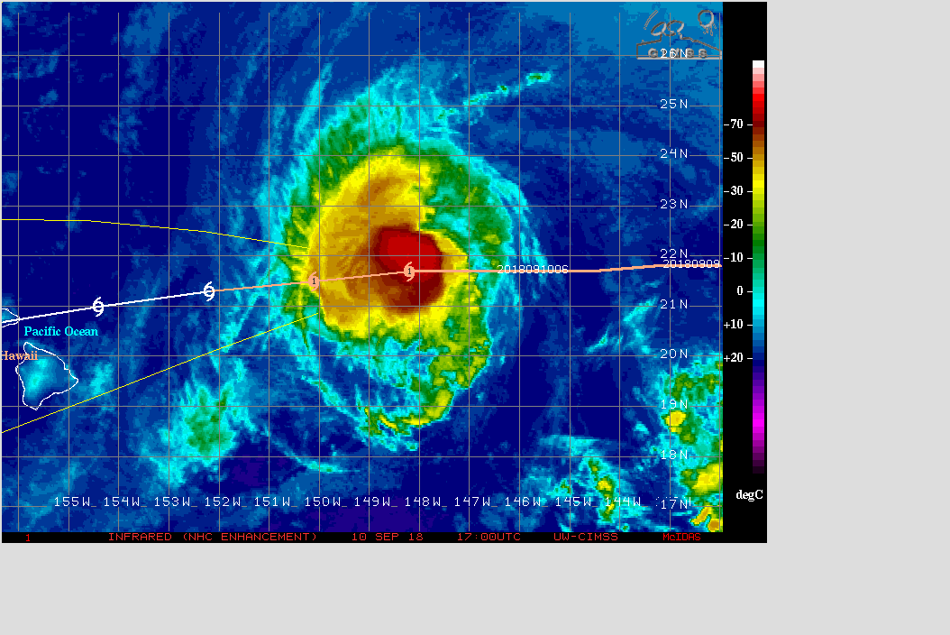
Tropical depression #6 in the Atlantic Basin strengthened into Tropical Storm Florence today (IR image); forecasters at the National Hurricane Center utlized a CIMSS AMSU estimate of 1003 mb central pressure... Read More
Tropical depression #6 in the Atlantic Basin strengthened into Tropical Storm Florence today (IR image); forecasters at the National Hurricane Center utlized a CIMSS AMSU estimate of 1003 mb central pressure... Read More
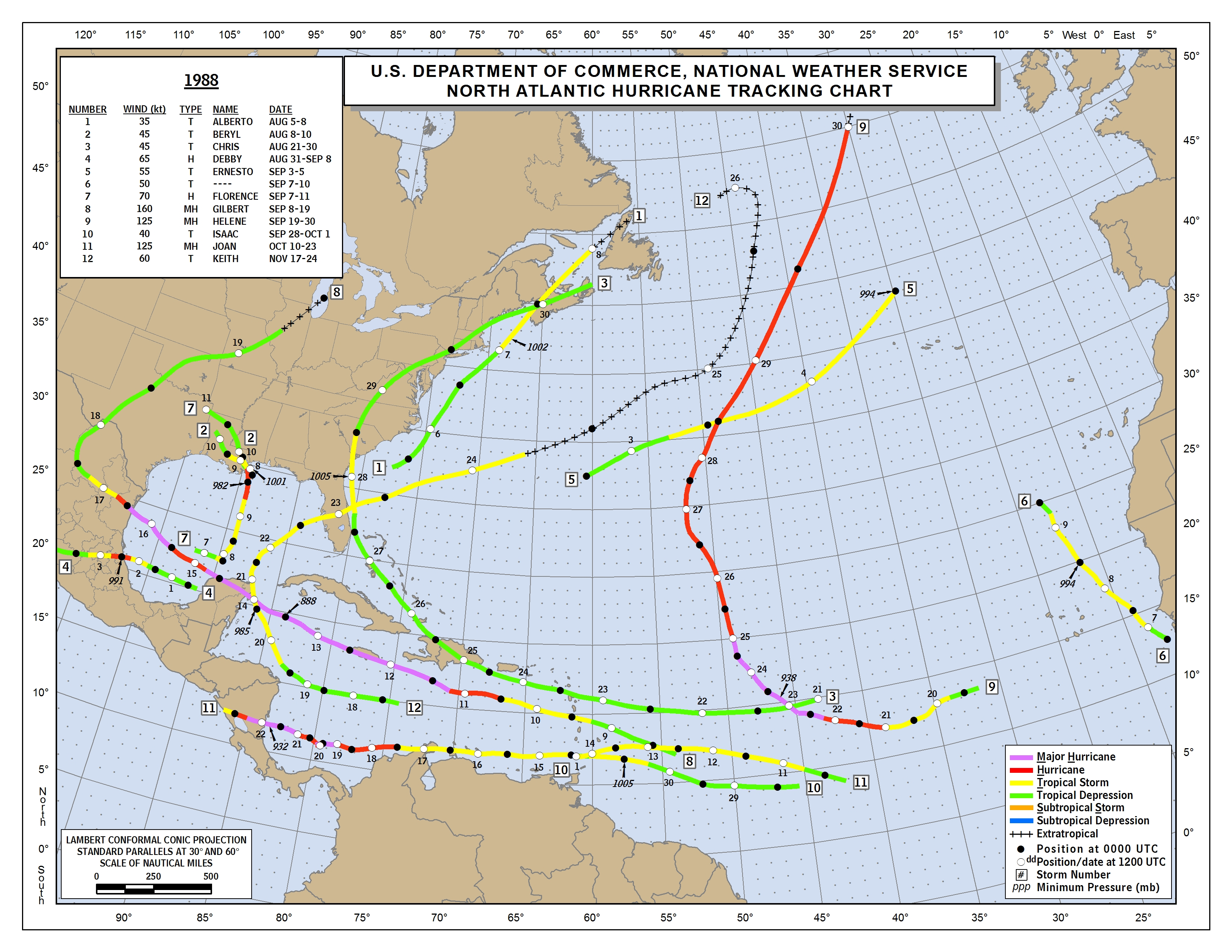
Hurricane Gilbert (1988) is one of the most intense Atlantic-basin hurricane on record. NOAA’s GOES-7 offer both visible and infrared views of the storm. These images are from the VISSR mode. What is unique about the view from the geostationary orbit, is that it allows both large / synoptic scale... Read More

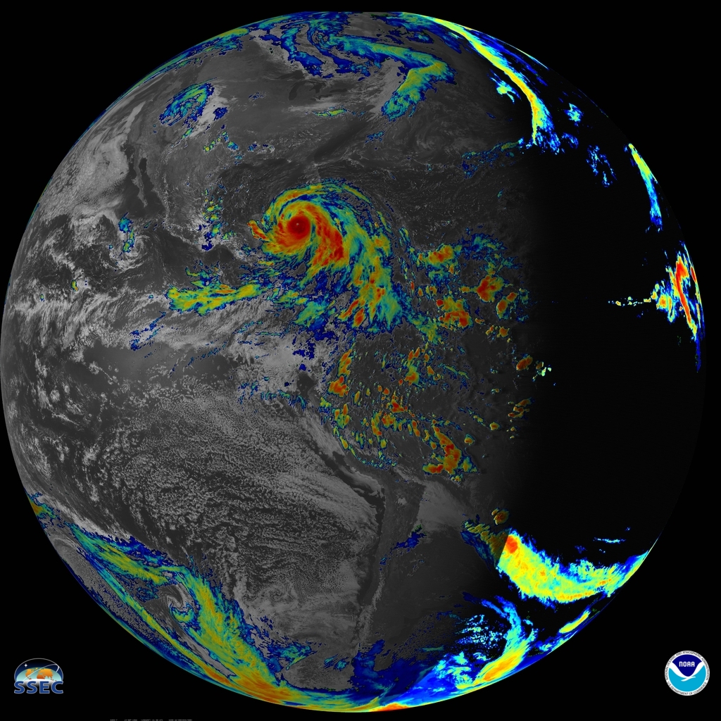
* GOES-17 images shown here are preliminary and non-operational *GOES-17 Full Disk natural color Red-Green-Blue (RGB) images (above; courtesy of Dave Stettner, CIMSS) revealed the very active tropics across the East Pacific and North Atlantic basins on 10 September 2018 — from left to right, Hurricane Olivia and Tropical Storm Paul in the Pacific... Read More
Two features of interest appeared on McIDAS images of GOES-13 0.63 µm visible channel data (above; click image to play animation) on the morning of 05 December 2012: (1) fingers of valley fog across much of Kentucky, which dissipated as daytime heating and... Read More
