This website works best with a newer web browser such as Chrome, Firefox, Safari or Microsoft Edge. Internet Explorer is not supported by this website.

Archive: Jan 2019

PyroCumulonimbus cloud in Australia

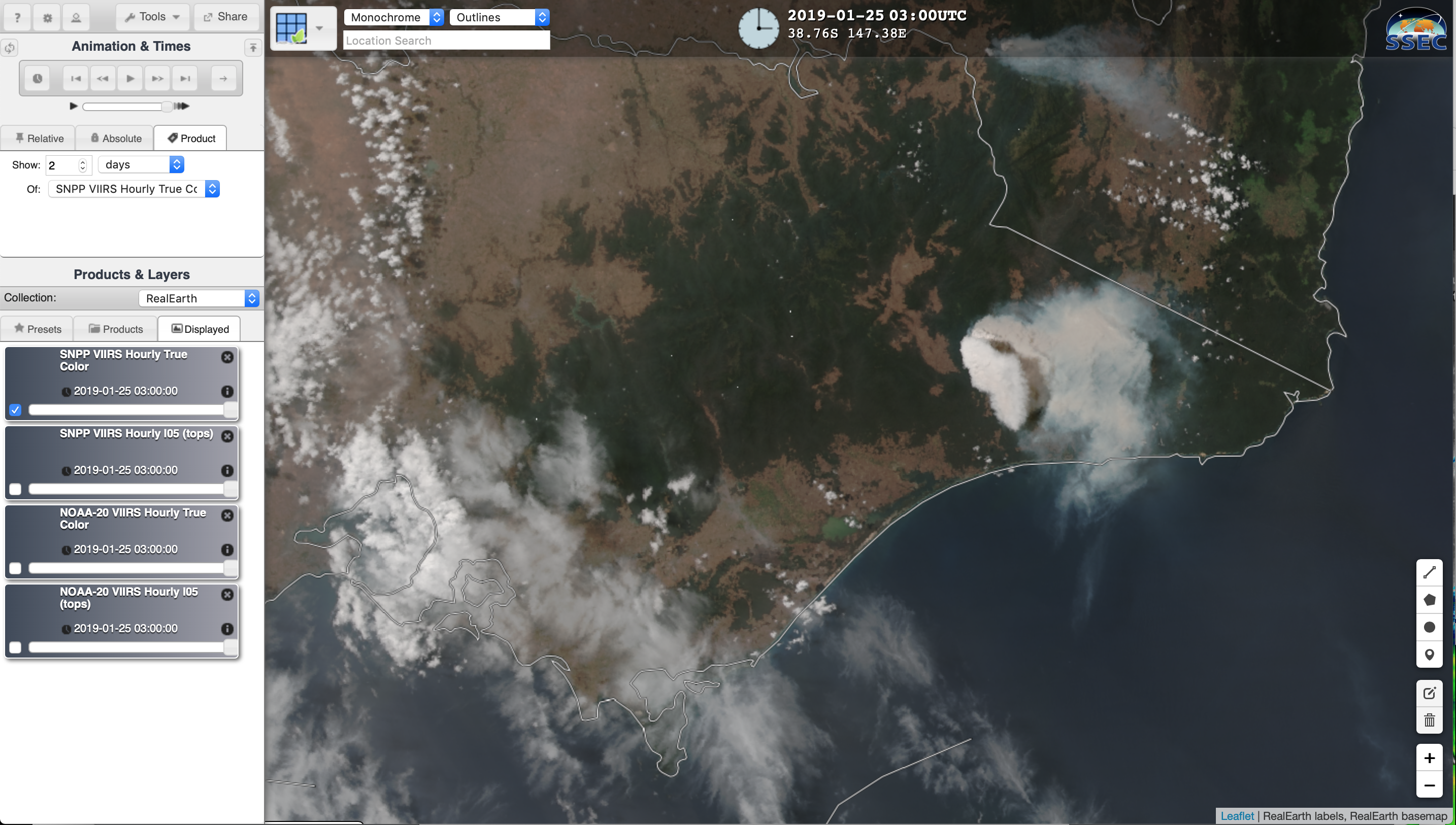
JMA Himawari-8 “Red” Visible (0.64 µm), Shortwave Infrared (3.7 µm) and Infrared Window (10.3 µm) images (above) showed the development of a pyroCumulonimbus (pyroCb) cloud from a bushfire that was burning in the eucalypt forests of eastern Victoria, Australia on 25 January 2019. A rapid-scan “Target” sector was positioned over... Read More

Ice accrual from freezing rain/drizzle in the Northeast US

A large central/eastern US winter storm impacted much of the Northeast with rain, snow, freezing rain/drizzle and strong winds on 20 January 2019 (surface analyses) — and a post-storm comparison of GOES-16 (GOES-East)  “Red” Visible (0.64 µm) and Near-Infrared “Snow/Ice” (1.61 µm) images on 22 January (above) revealed a dark 1.61 µm signature (often indicative of significant ice accrual)... Read More