This website works best with a newer web browser such as Chrome, Firefox, Safari or Microsoft Edge. Internet Explorer is not supported by this website.

Archive: May 2015

Typhoon Dolphin approaches Guam

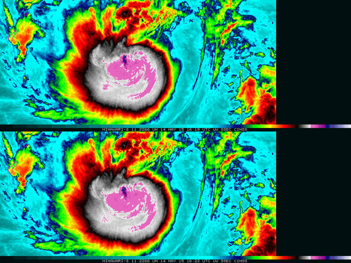
The animation above (available here as an mp4, and here on YouTube) shows 11.22 µm infrared imagery at 2.5-minute time steps (bottom) and 10-minute time steps (top) from Himawari-8 on 14 May 2015. Category 2 intensity Typhoon Dolphin is approaching Guam, seen at the left edge of both panels in... Read More

Super Typhoon Noul in the West Pacific Ocean

Following a period of rapid intensification, Super Typhoon Noul reached Category 5 strength late in the day on 09 May 2015 (ADT plot) as it slowly approached the northern tip of the Philippine island of Luzon. The Japanese Meteorological Agency (JMA) positioned one of the Himawari-8 rapid-scan “target” areas over the... Read More

Tropical Disturbance off the Southeast US Coast

A disorganized subtropical system (Invest Area 90L) located over the southwest Atlantic to the east of Georgia and north of the Bahamas has the potential to become the first named system of the 2015 Atlantic Tropical Season (if named as a subtropical storm, this would be Ana). Visible imagery, above,... Read More