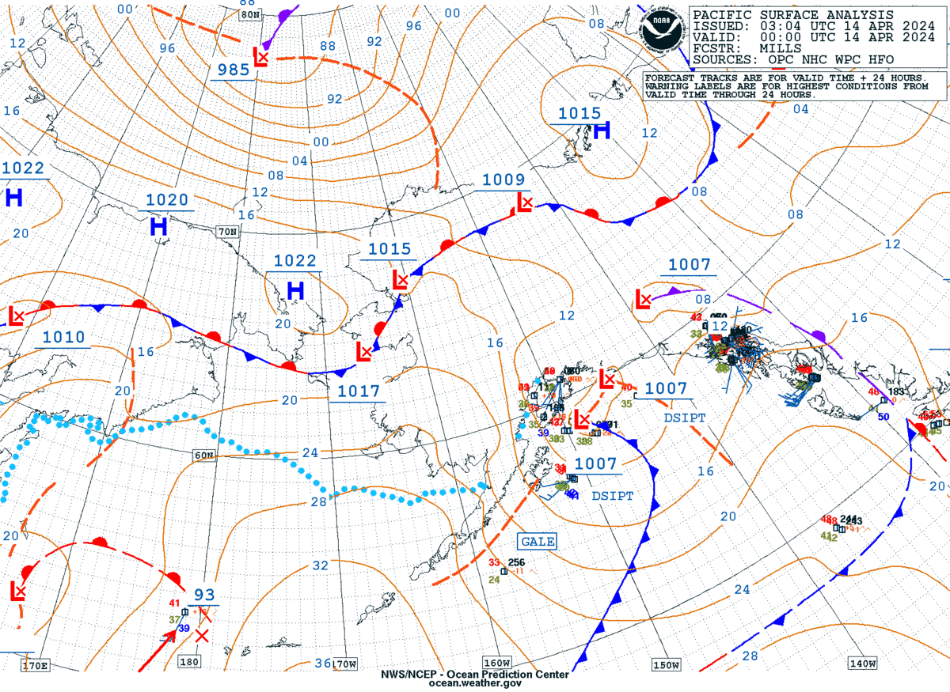
Arctic low north of Alaska, and its effect on ice in the Beaufort Sea
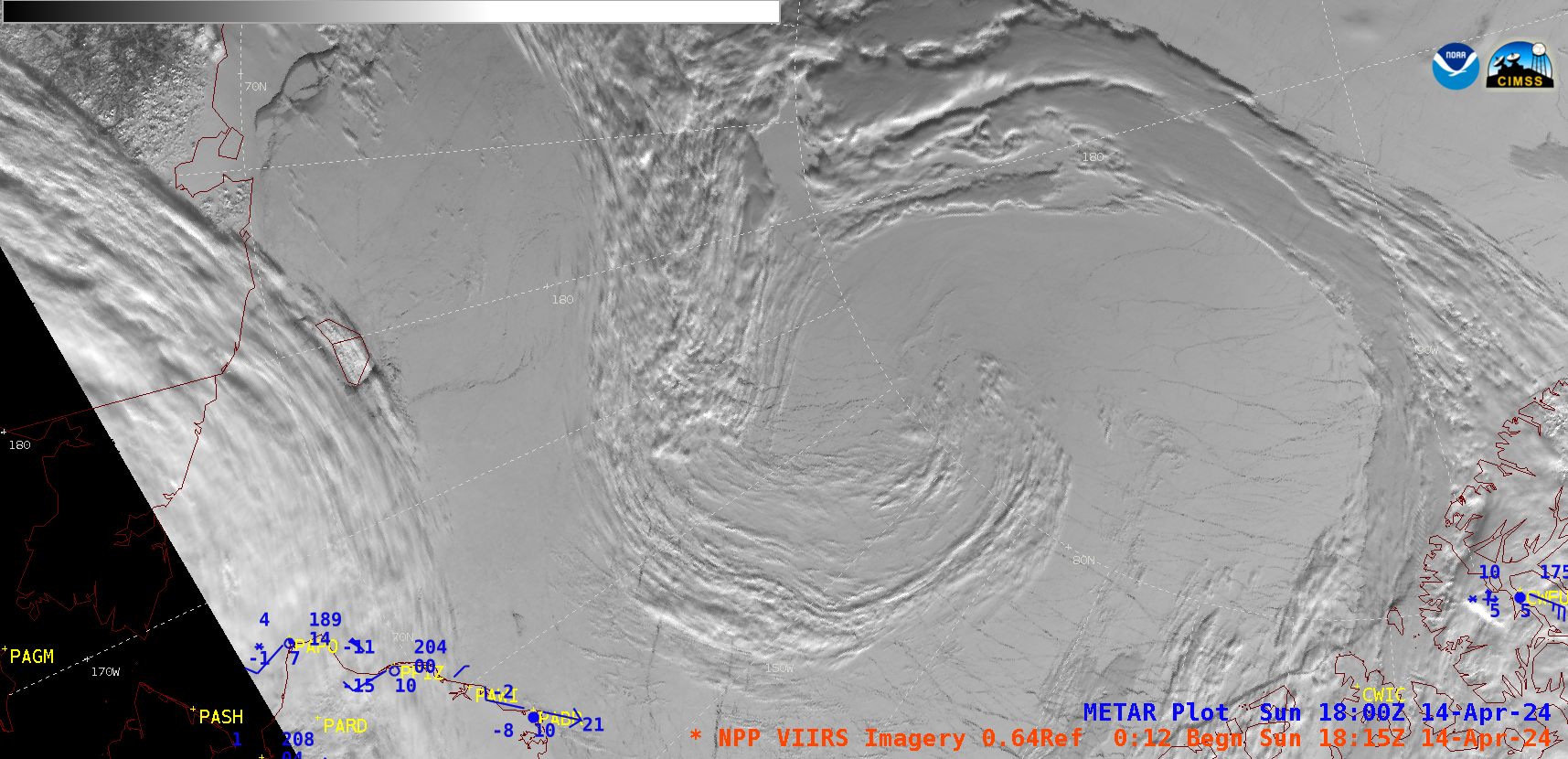
A sequence of Suomi-NPP VIIRS Visible (0.64) images (above) displayed the cyclonically-curved cloud structure associated with an Arctic low pressure system (surface analyses) located between Alaska and the North Pole on 14 April 2024. A blend of Atmospheric Motion Vectors derived from NOAA-20 and NOAA-21 (below) showed the flow pattern at... Read More
