This website works best with a newer web browser such as Chrome, Firefox, Safari or Microsoft Edge. Internet Explorer is not supported by this website.

Category: Severe convection

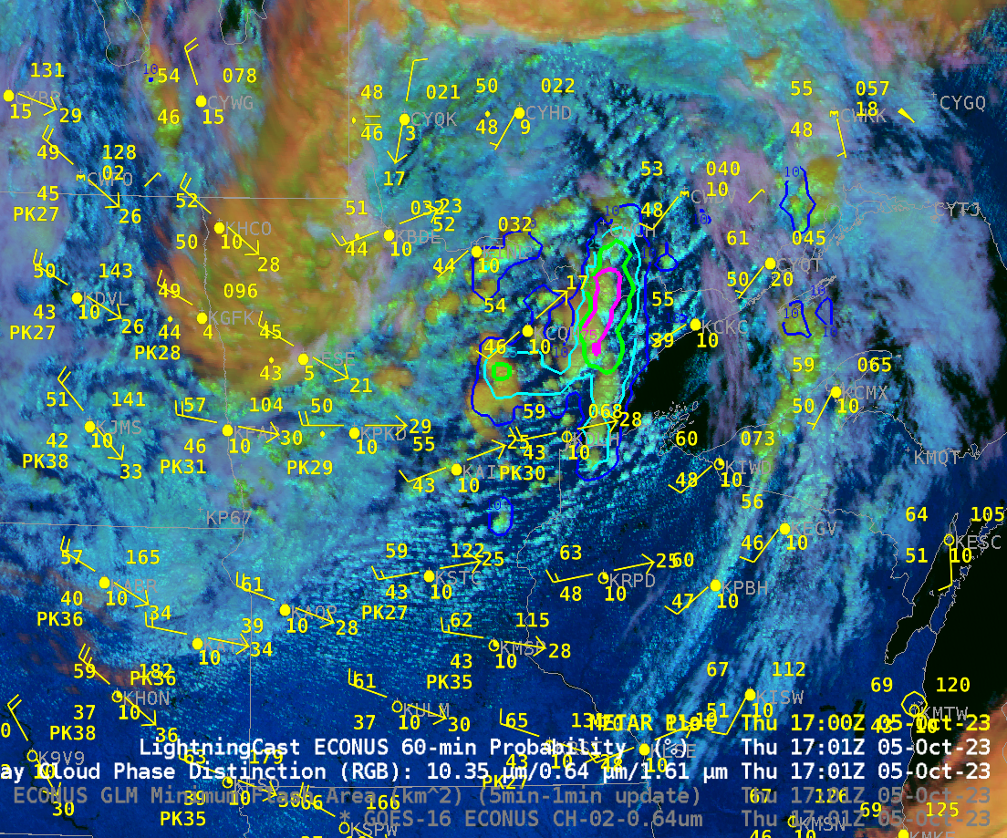
Severe Weather over Lower Michigan

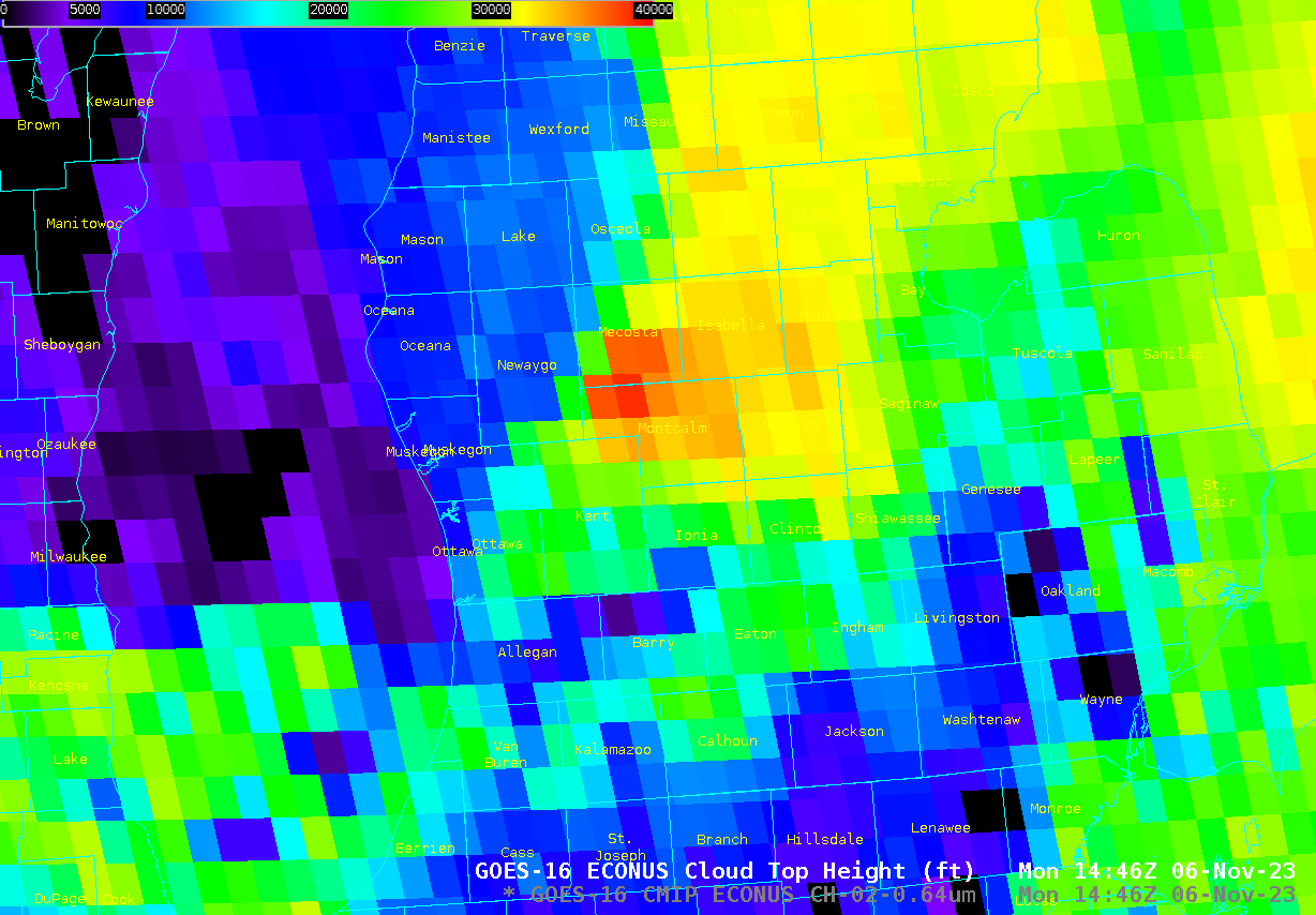
Storm Reports for the first two weeks of November 2023 show that the all but one of the reports have occurred over lower Michigan, where large hail (1 to 1.5 inches in diameter) occurred shortly after sunrise on 6 November in Newaygo County (1423 UTC), Montcalm County (1440, 1443 UTC) and... Read More

LightningCast probabilities in the cool season

Seasonably cool Fall-like temperatures overspread the western Great Lakes and northern Plains on 5 October. The animation above shows the Day Cloud Phase Distinction overlain with LightningCast probability from 1321-1721 UTC on 5 October (that is, 8:21-12:21 CDT). SPC on this day was anticipating general thunder over northern Minnesota. Given that,... Read More

Severe Weather in North Texas

The North Texas panhandle is experiencing severe weather on October 4, 2023. Animation 1 shows Radar reflectivity in tight areas of convection across the panhandle. The GOES Day Cloud Phase Distinction RGB shown in Animation 2 confirms convection, showing overshooting tops becoming wispy ice clouds (appearing orange in the RGB).An enhanced risk of convection... Read More

Severe thunderstorms in Kansas, Oklahoma and Texas

1-minute Mesoscale Domain Sector GOES-16 (GOES-East) “Red” Visible (0.64 µm) images (above) included time-matched (+/- 3 minutes) plots of SPC Storm Reports — which showed severe thunderstorms that moved eastward and southeastward across parts of Kansas, Oklahoma and Texas on 19 September 2023.1-minute GOES-16 “Clean” Infrared Window (10.3 µm) images (below) indicated that the coldest pulsing overshooting tops associated many of the... Read More