Cyclone Shaheen makes landfall in Oman
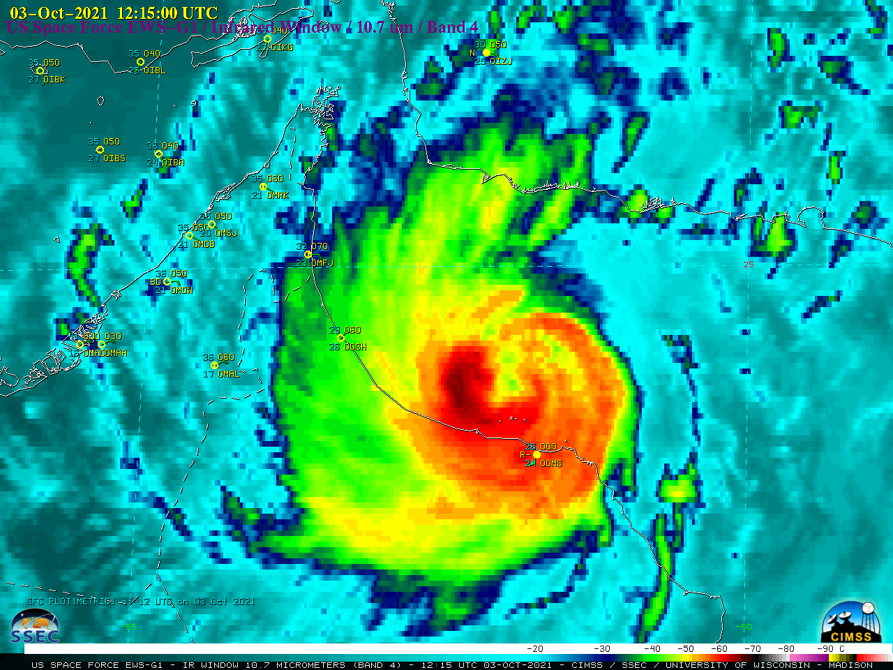
US Space Force EWS-G1 (formerly GOES-13) Infrared Window (10.7 µm) images (above) showedHurricane Shaheen weakening to a Tropical Storm shortly after it made a rare landfall along the coast of Oman on 03 October 2021. The storm exhibited an eye at times as it was a Category 1 Hurricane over... Read More