This website works best with a newer web browser such as Chrome, Firefox, Safari or Microsoft Edge. Internet Explorer is not supported by this website.

Category: GOES-15

NWS Juneau, Alaska issues their first-ever Severe Thunderstorm Warning — based on satellite imagery

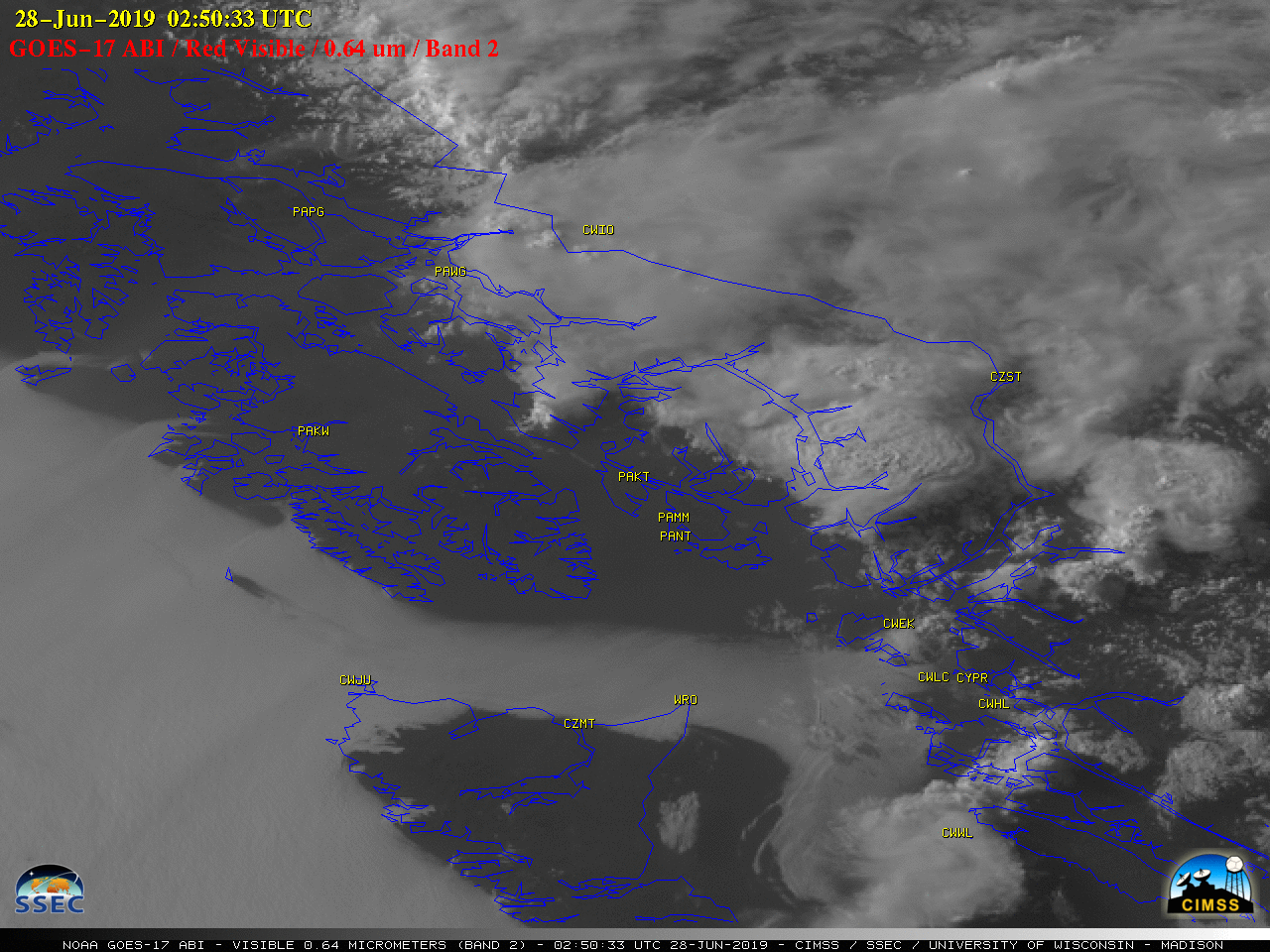
1-minute Mesoscale Domain Sector GOES-17 (GOES-West) “Red” Visible (0.64 µm) images (above) showed the development of thunderstorms over the far southern end of the Alaska Panhandle on 27 June 2019. These storms intensified as they moved southeastward toward the Misty Fjords area of Alaska (located east and southeast of Ketchikan PAKT) — and when... Read More

Anomalous cutoff low over the Beaufort Sea

A comparison of Water Vapor images from GOES-17 (GOES-West) and GOES-15 Water Vapor images (above) showed the signature of an anomalously-deep closed low that was moving southeastward over the Beaufort Sea north of Alaska during the 11 June – 12 June 2019 period. The images are shown in the native... Read More