Updating GOES Cloud Climatology for the April 8, 2024 Total Solar Eclipse
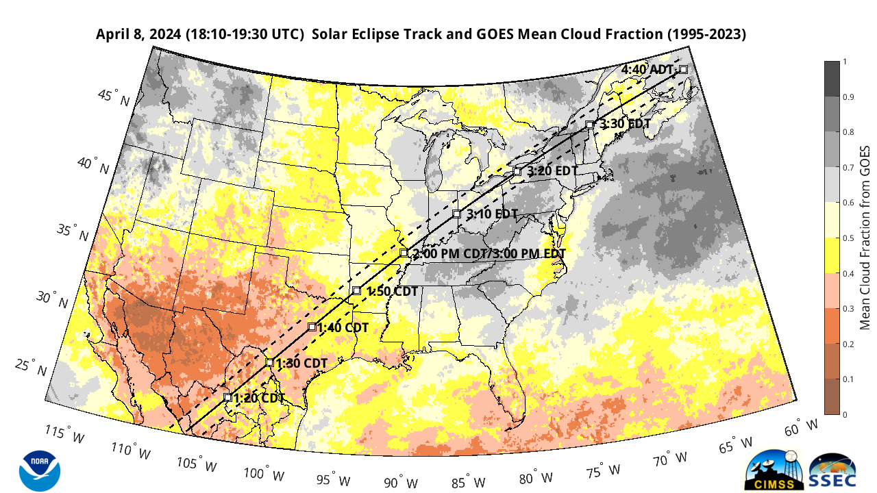
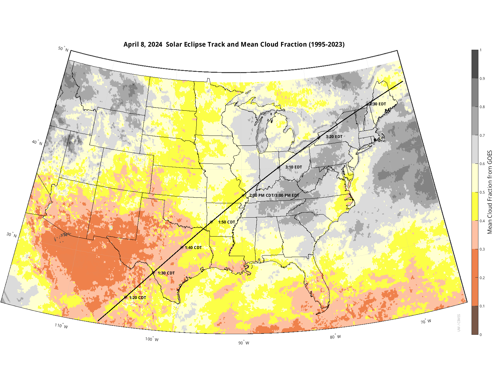
By now you probably already know that a total solar eclipse will traverse North America during the afternoon of April 8, 2024. There have been many stories in the media and previous blog entries here at the CIMSS Satellite Blog: Will it be Cloudy on April 8th (2024)? and GOES Cloud Climatology on April 8th.The Washington Post liked our previous GOES cloud climatology image... Read More