Super Fog causes multi-vehicle accidents along Interstate 55 in Louisiana
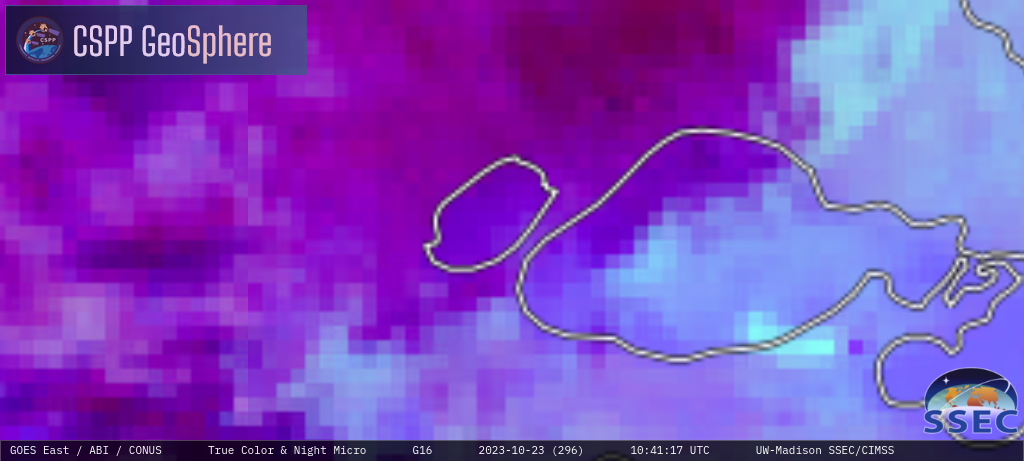
A Super Fog event — caused by the combination of dense fog and smoke from a large swamp fire just southeast of Lake Pontchartrain — was responsible for multi-vehicle accidents along Interstate 55 (between Lake Maurepas and Lake Pontchartrain) during the early morning hours on 23 October 2023 (meda report). Before a patch of... Read More
