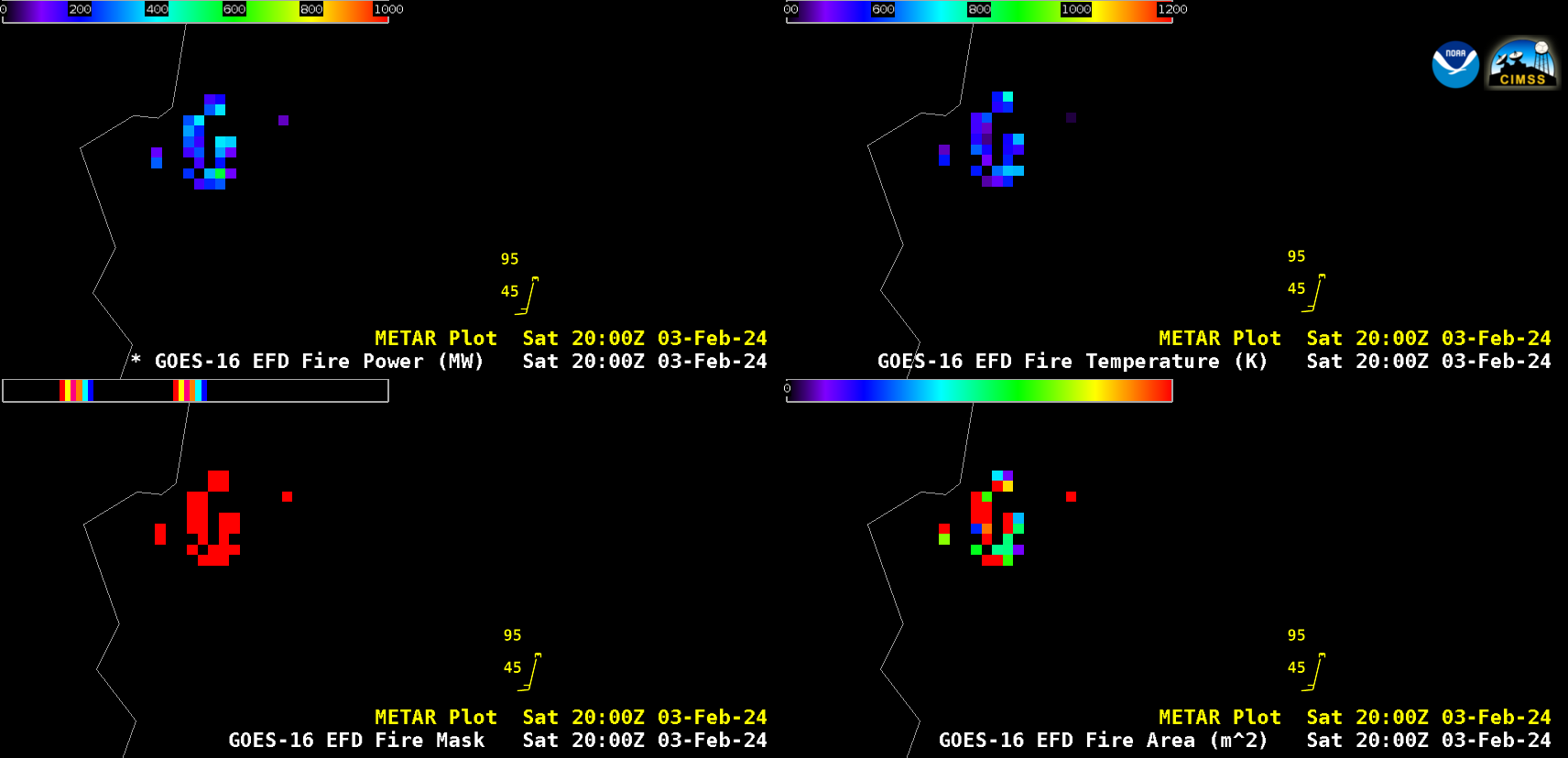
Wind-driven grass fires in Nebraska
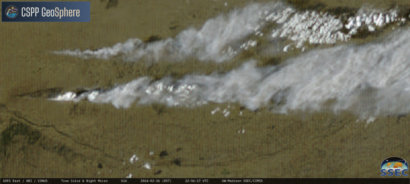
5-minute CONUS Sector GOES-16 (GOES-East) True Color RGB images + Nighttime Microphysics RGB images from the CSPP GeoSphere site (above) showed large smoke plumes produced by 2 wind-driven grass fires in central Nebraska (just north of North Platte) on 26 February 2024. The burn scar associated with the larger (southernmost) fire was very apparent, as... Read More