This website works best with a newer web browser such as Chrome, Firefox, Safari or Microsoft Edge. Internet Explorer is not supported by this website.

Category: DMSP

Cyclone Batsirai reaches Category 4 intensity

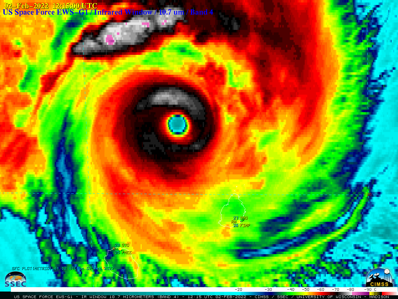
US Space Force EWS-G1 (formerly GOES-13) Infrared Window (10.7 µm) images (above) showed Cyclone Batsirai in the South Indian Ocean — just north of the island nations of Mauritius and Réunion — during the time period it was classified as a Category 4 intensity storm (00 UTC on 02 February... Read More

Typhoon Tiffany makes landfall in Australia

JMA Himawari-8 Visible (0.64 µm) images (above) showed Tropical Cyclone Tiffany as it made landfall along the eastern coast of the Cape York Peninsula in Queensland, Australia on 09 January 2022. [UPDATE: just prior to making landfall around 0130 UTC on 10 January, Tiffany intensified to a Category 1 typhoon... Read More

Hurricane Ida develops an eye over the Gulf of Mexico, as intensification continues until landfall

1-–minute Mesoscale Domain Sector GOES-16 (GOES-East) “Red” Visible (0.64 µm) and “Clean” Infrared Window (10.35 µm) images (above)  showed that Hurricane Ida gradually developed an eye, as the Category 1 storm intensified to Category 2 by 1800 UTC on 28 August 2021.Microwave (85 GHz) images from DMSP-17 (above) and DMSP-16 (below) — from the CIMSS Tropical Cyclones site — provided 2 views of the eye... Read More