Thunderstorm over the Arctic Ocean
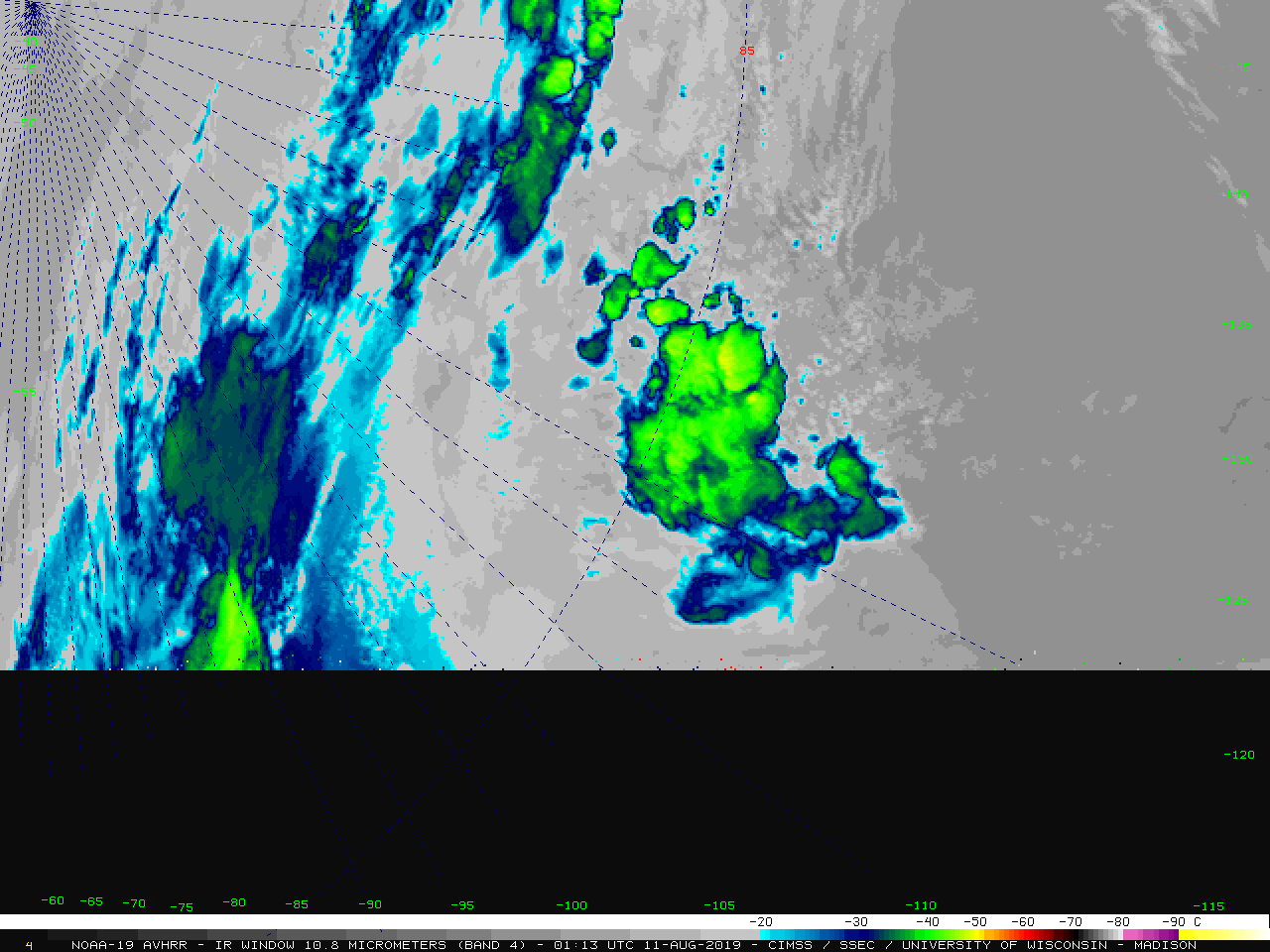
NOAK49 PAFG 110400 CCA PNSAFG AKZ222-111600- Public Information Statement…CORRECTED National Weather Service Fairbanks AK 800 PM AKDT Sat Aug 10 2019 …Lightning Detected within 300 Miles of North Pole Today… A number of lightning strikes were recorded between 4pm and 6pm today within 300 miles of the North Pole. The... Read More
