Flooding in Southern California
![1-minute GOES-16 Infrared Window (10.3 µm) images; with hourly reports of surface weather type plotted in yellow [click to play MP4 animation]](https://cimss.ssec.wisc.edu/satellite-blog/wp-content/uploads/sites/5/2018/01/G16_IR_WXS_SOCAL_08_09JAN2018_960x1280_B13_2018009_180129_0001PANEL_01322.GIF)
1-minute GOES-16 Infrared Window (10.3 µm) images; with hourly reports of surface weather type plotted in red [click to play MP4 animation]
GOES-16 “Red” Visible (0.64 µm) images (below) showed some of the features which helped produce heavier rainfall and snowfall during the daylight hours on 09 January.
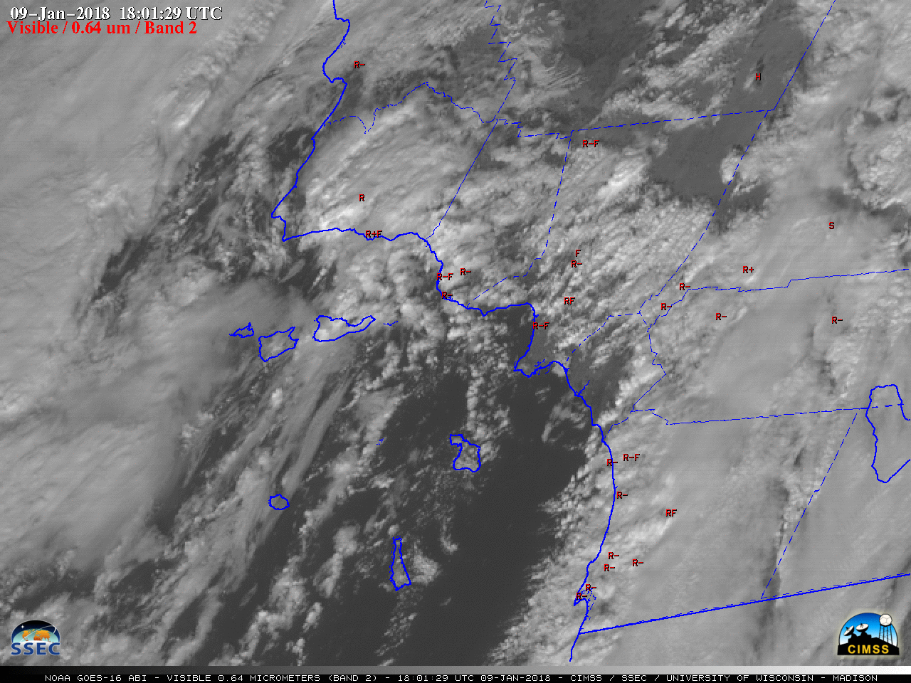
1-minute GOES-16 “Red” Visible (0.64 µm) images; with hourly reports of surface weather type plotted in red [click to play MP4 animation]
![1-minute GOES-16 Water Vapor (6.9 µm) images; with hourly reports of surface weather type plotted in red [click to play MP4 animation]](https://cimss.ssec.wisc.edu/satellite-blog/wp-content/uploads/sites/5/2018/01/G16_WV_WXS_SOCAL_08_09JAN2018_960x1280_B9_2018009_180129_0001PANEL_01322.GIF)
1-minute GOES-16 Water Vapor (6.9 µm) images; with hourly reports of surface weather type plotted in red [click to play MP4 animation]
===== 10 January Update =====
![Suomi NPP VIIRS True-color and False-color RGB images [click to enlarge]](https://cimss.ssec.wisc.edu/satellite-blog/wp-content/uploads/sites/5/2018/01/180110_2051utc_suomi_npp_viirs_truecolor_falsecolor_SoCal_anim.gif)
Suomi NPP VIIRS True-color and False-color RGB images [click to enlarge]
A closer look at the Thomas Fire burn scar was provided by 30-meter resolution Landsat-8 False-color RGB imagery (below), which showed thin filaments of muddy sediment just offshore, as well as fresh snow cover (shades of cyan) along or immediately adjacent to the northeastern edge of the burn scar (in the Hines Peak area). On 10 January, the fire was listed as 92% contained (100% containment was declared on 12 January).
![Landsat-8 False-color RGB image [click to enlarge]](https://cimss.ssec.wisc.edu/satellite-blog/wp-content/uploads/sites/5/2018/01/180110_1834utc_landsat8_falsecolor_Thomas_Fire_CA_burn_scar_anim.gif)
Landsat-8 False-color RGB image [click to enlarge]
===== 11 January Update =====
![Suomi NPP VIIRS True-color images on 10 January and 11 January [click to enlarge]](https://cimss.ssec.wisc.edu/satellite-blog/wp-content/uploads/sites/5/2018/01/180110_180111_suomi_npp_viirs_truecolor_anim.gif)
Suomi NPP VIIRS True-color images on 10 January and 11 January [click to enlarge]
Farther to the south, offshore sediment transport was also seen in the San Diego area (below).
![Suomi NPP VIIRS True-color image on 11 January [click to enlarge]](https://cimss.ssec.wisc.edu/satellite-blog/wp-content/uploads/sites/5/2018/01/180111_2030utc_suomi_npp_viirs_truecolor_sgx_anim.gif)
Suomi NPP VIIRS True-color image on 11 January [click to enlarge]