Weak tornado in San Juan, Puerto Rico
An email from SSEC/CIMSS employee Shane Hubbard discussed details of a weak tornado in San Juan, Puerto Rico on 06 October 2017:
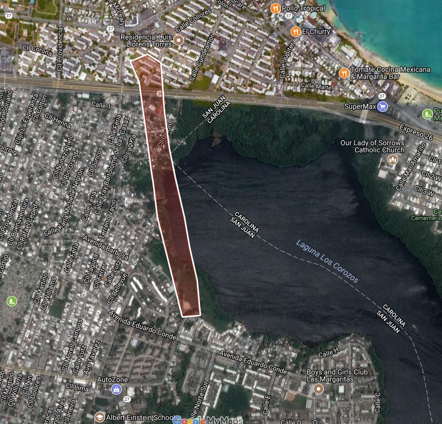
While I was working in San Juan last week a tornado formed close to the shoreline of Lake (Lagoon) Los Corozos, moved over the water, and then damaged homes in a neighborhood named ‘Playita’ where I was working. The tornado formed near 18.439089, -66.041962 on October 6th around 4:25pm AST. 10+ roofs were damaged from the event. Many of those roofs had already been repaired by residents or by the carpenters that were volunteering in the community. It was a very depressing event to say the least.
Here are links to the tornado.
https://www.youtube.com/watch?v=Oc8j4uLPQvg
Approximate tornado path (courtesy of Shane Hubbard)
* GOES-16 data posted on this page are preliminary, non-operational and are undergoing testing *
![GOES-16 Visible (0.64 µm, left) and Infrared Window (10.3 µm, right) images, with hourly San Juan surface data plotted in yellow [click to play MP4 animation]](https://cimss.ssec.wisc.edu/satellite-blog/wp-content/uploads/sites/5/2017/10/958x638_AGOES16_B213_G16_VIS_IR_MESO_TJSJ_PR_06OCT2017_2017279_202558_0002PANELS.GIF)
GOES-16 Visible (0.64 µm, left) and Infrared Window (10.3 µm, right) images, with hourly San Juan surface data plotted in yellow [click to play MP4 animation]
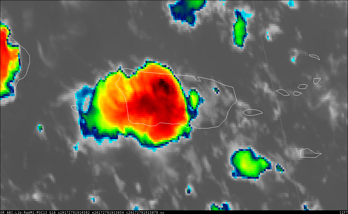
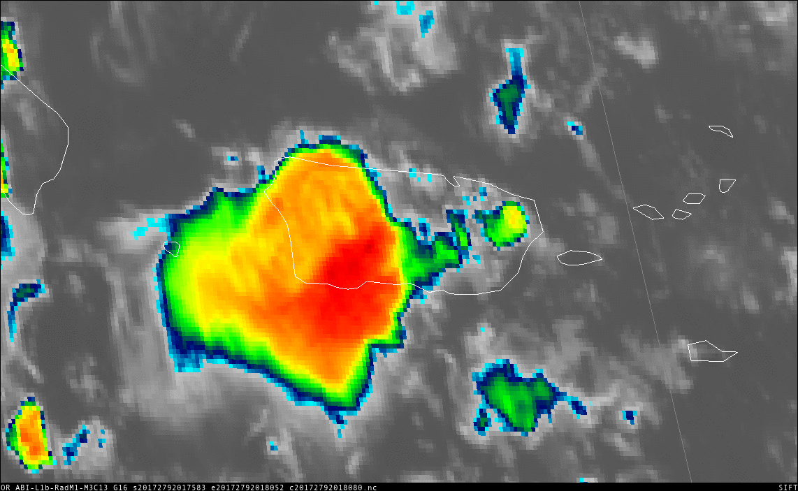
Convective initiation occurred over the far eastern end of the island about an hour before the tornado — cloud-top infrared brightness temperatures cooled to around -70ºC (black enhancement) around the time of the tornado (2025 UTC) during a second burst of convection.
Of particular note is the speed with which the second convective storm grew. Between 2020 UTC and 2025 UTC, the cloud-top infrared brightness temperatures cooled 20ºC in the region of thunderstorm development! The bar graphs below show the brightness temperature distribution in the region of convective development.
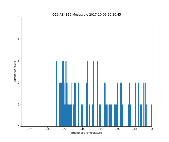
Cloud-Top Brightness Temperatures over a Tornadic Convective Storm at 2020 and 2025 UTC on 6 October 2017 (Click to enlarge)
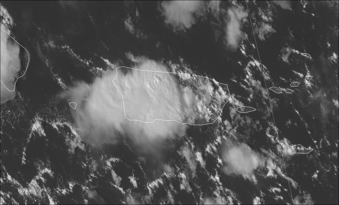
The animation below shows GOES-16 10.3 µm Clean Infrared Window images for 10 minutes: 2017-2026 UTC on 6 October. Very strong convective development is apparent, overlapping with the 2025 UTC time of the tornado.
GOES-16 “Clean Window” 10.3 µm Imagery, 2017-2026 UTC on 6 October 2017 (Click to enlarge)