Typhoon Koppu hits the Philippines
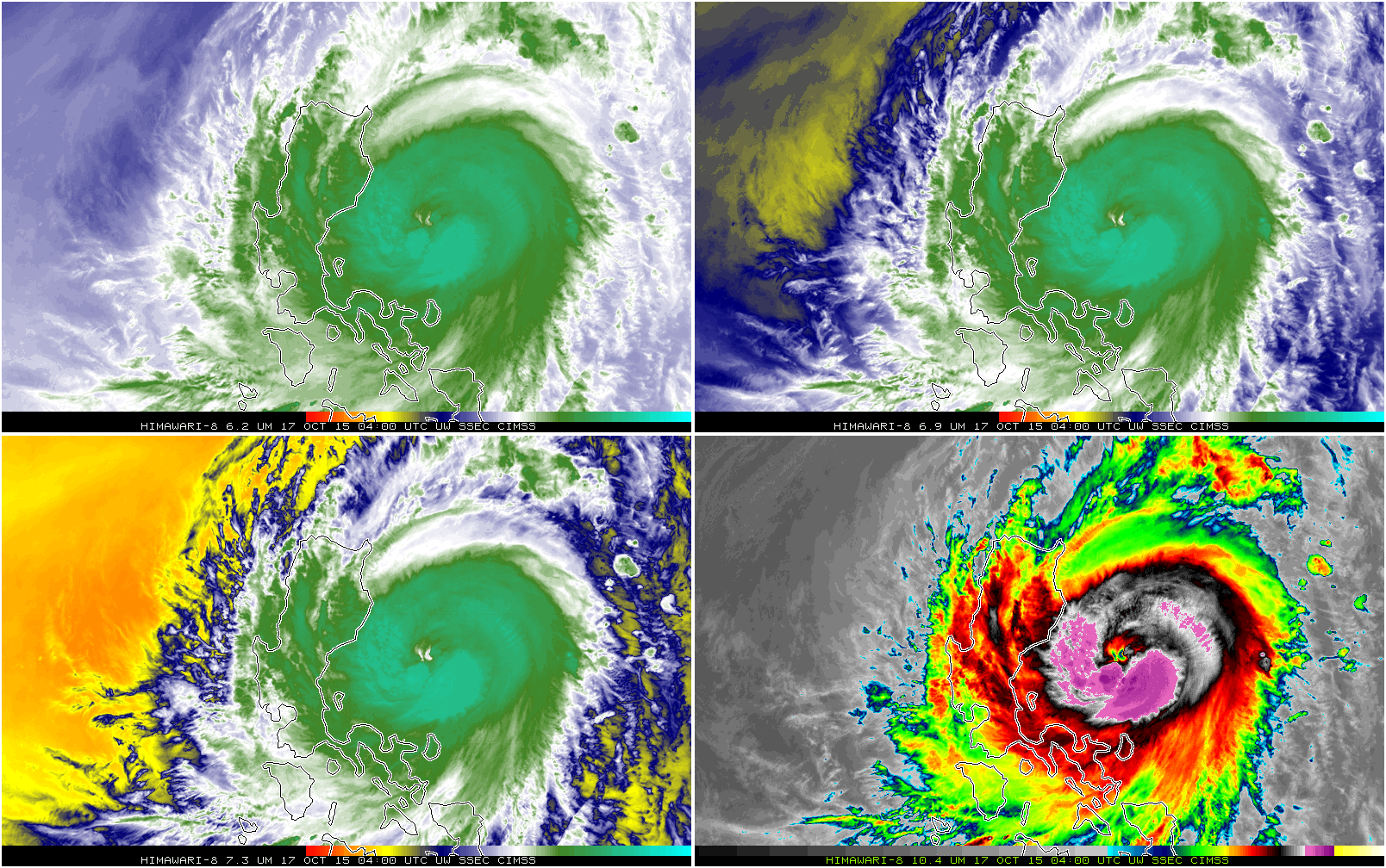
![Himawari-8 Infrared Imagery, 0400-2030 UTC 17 October 2015 [click for mp4 animation]](https://cimss.ssec.wisc.edu/satellite-blog/wp-content/uploads/sites/5/2015/10/H8_4Panel_17Oct2015_1800.GIF)
Himawari-8 Infrared Imagery, 0400-2030 UTC 17 October 2015; 6.2 µm (Upper Left), 6.9 µm (Upper Right), 7.3 µm (Lower Left), 10.35 µm (Lower Right) [click for mp4 animation]
![Morphed Microwave Imagery showing Koppu's Eyewall [click to enlarge]](https://cimss.ssec.wisc.edu/satellite-blog/wp-content/uploads/sites/5/2015/10/Koppu_Microwave_gifsBy12hr_17Oct2015.gif)
Morphed Microwave Imagery showing Koppu’s Eyewall [click to enlarge]
![MIMIC Total Precipitable Water over the Western North Pacific Basin [click to enlarge]](https://cimss.ssec.wisc.edu/satellite-blog/content/uploads/2015/10/MIMIC_TPW_72hEnding1200_19Oct2015.gif)
MIMIC Total Precipitable Water over the Western North Pacific Basin [click to enlarge]
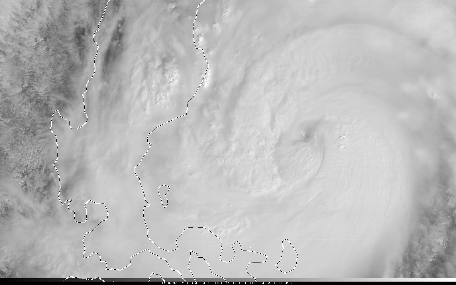
![Himawari-8 Visible Imagery (0.63) from 0100 through 0930 UTC on 17 October [click to animate]](https://cimss.ssec.wisc.edu/satellite-blog/wp-content/uploads/sites/5/2015/10/H8VISKoppu_17Oct_0100_0930anim.gif)
Himawari-8 Visible Imagery (0.63) from 0100 through 0930 UTC on 17 October [click to animate]