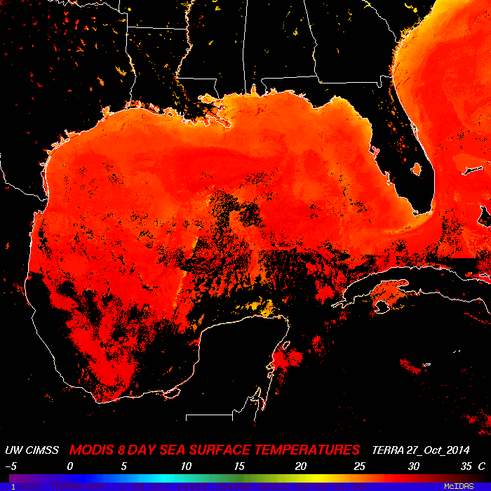
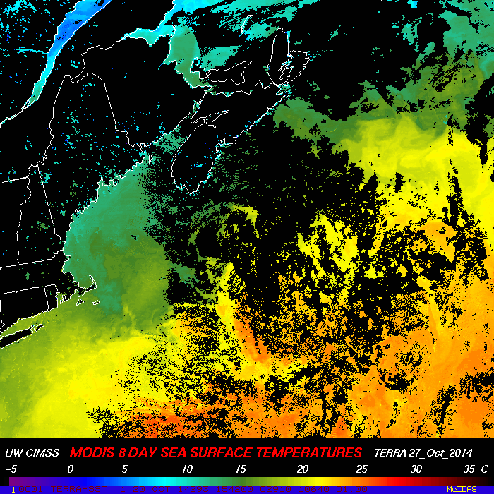
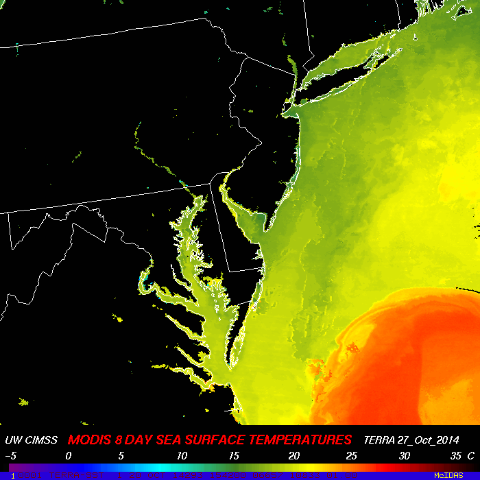
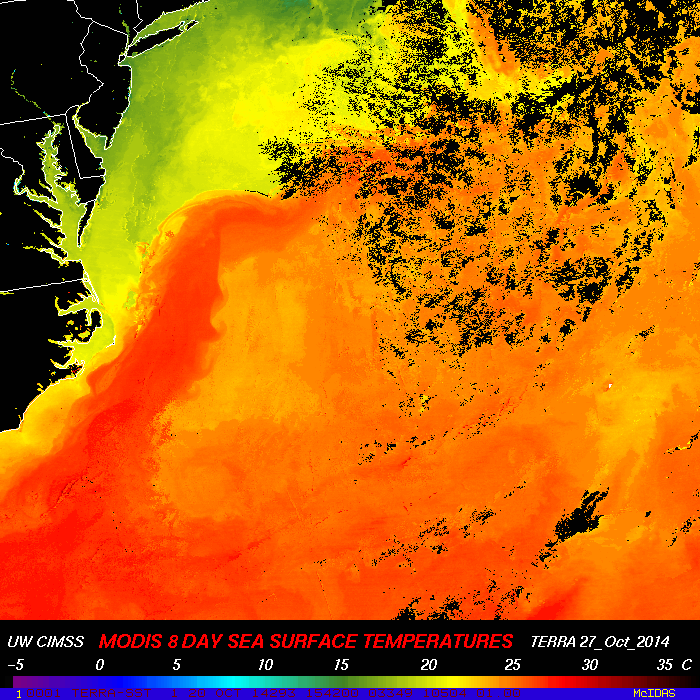
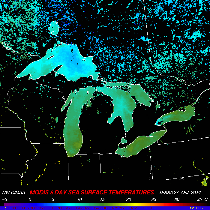
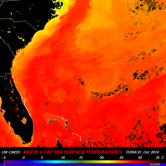
These images were created using MODIS high resolution data down linked from the satellite directly to the antenna at the top of the Space Science and Engineering Center at the University of Wisconsin-Madison. The Sea Surface Temperatures are produced using the MODIS direct broadcast SST software distributed as part of the International MODIS/AIRS Processing Package (IMAPP). For more information on the algorithm, please see this reference. SST images are created using the McIDAS visualization and analysis tool. It should be noted that the SST values in coastal regions and over small lakes may contain some land contamination and therefore these values may not be accurate representations of actual water values. This includes many of the small lakes in Southern Canada. Eight day composites are combined by selecting the warmest clear sky value that was found within that eight day period. The eight day composites are updated daily at 22 UTC. This work is funded by the National Aeronautics and Space Administration (NASA).
Applets Copyright 2006 by Tom Whittaker. Images prepared by Kathleen Strabala.