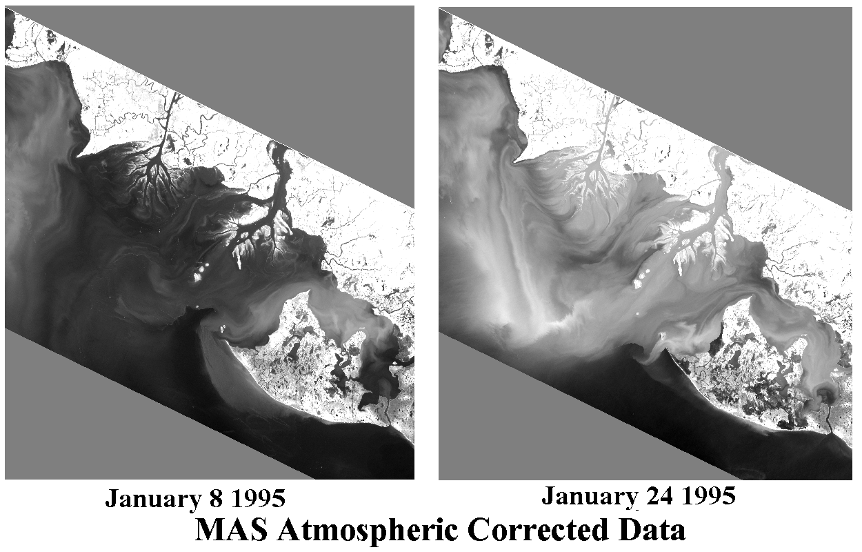
| MAS near infrared images on January 8 and 24 demonstrate variability of turbidity in the Atchafalaya Bay over short time scales. On January 24 the turbidity maximum is in the Atchafalaya Bay while on January 8 the Atchafalaya Bay is a turbidity minimum. A surge in Atchafalaya River discharge, beginning about January 18 and Continuing beyond January 24, likely caused and sustained the Atchafalaya Bay turbidity maximum seen in the January 24 image. |
Last updated: May 19, 1998