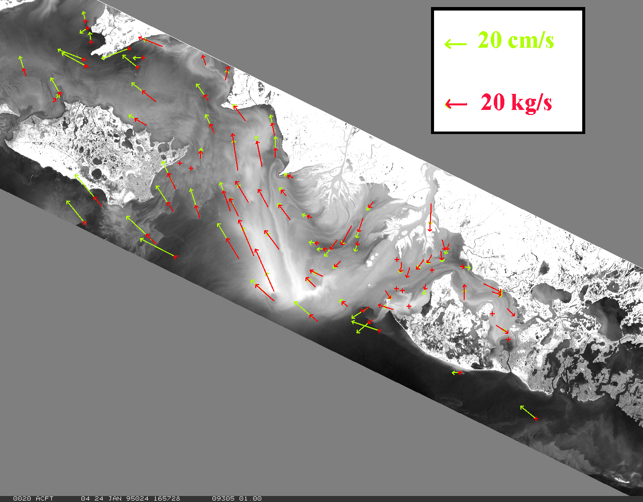
| Coastal Circulation in the Atchafalaya Bay area on January 24, 1995. Green vectors represent water motion, red vectors represent sediment transport. Water level has been rising steadily in the bay for six hours prior to this image. Winds were fairly weak (under 2 m/s) out of the northeast. Water flowing from the Atchafalaya River and the Wax Lake Outlet into Atchafalaya Bay is shown, on January 24, being transported primarily westward toward East Cote Blanche Bay. |