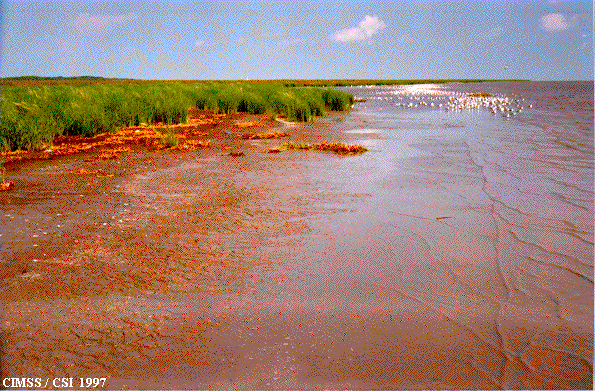
| This photo was taken on September 16, 1997. Visible in the picture is colonized marsh grass on the muddy plain, and accreting fluid mud (highly watered mud of yogurt consistency) near the water's edge. The small white objects in the background are birds. |
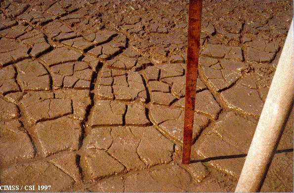
| This photo shows a close-up view of cracked mud along the Chenier Plain. Fluid mud deposits crack as exposed surfaces dry out. The meter stick provides scale. The object in the foreground is one of several sediment burial pipes used to measure vertical accretion along the Chenier Plain. |
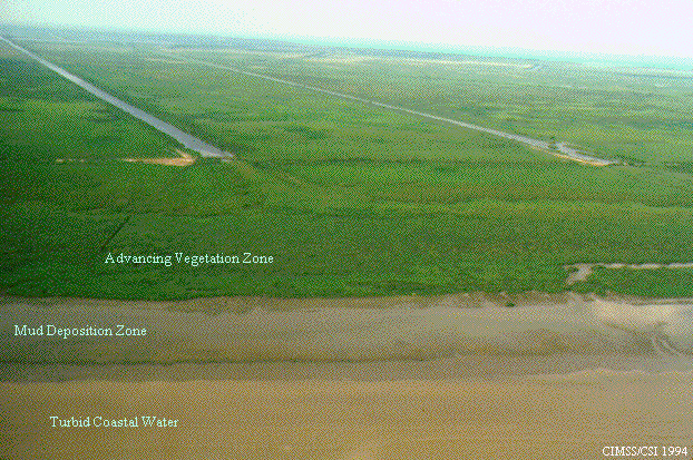
| Aerial view of the Chenier Plain on 6/18/94. Wave activity in the turbid coastal water transports fluid mud to the mud deposition zone where it becomes new landform. The new landform is eventually colonized by vegetation which contributes to the stabilization of the landform. Note the ends of the two man-made canals (approximately 700 meters from the shoreline) mark the shoreline as it was in the mid 1980s. |