Ingredients for a Tornado
The deffinition of a tornado is "a violently rotating column of air in contact with the ground". The two main ingredients for this rotation to develop are
big differences in the wind direction (wind shear) and big temperature differences between the surface and higher up in the clouds Since tornadoes form from the bottom of a thunderstorm, a satellite cant see tornadoes. Once a tornado is detected, satellites are used to track the storm.
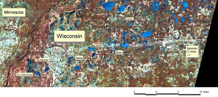
Satellite images also show stark pictures of tornado damage, especially from high resolution POES images. The white line on the map below outlines where a tornado destroyed trees and buildings in Wisconsin.
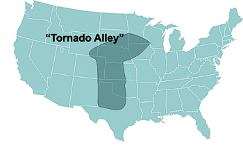
Some places in the United States have perfect conditions for strong thunderstorms and tornado development much of the year. This area has earned a nickname over time called "Tornado Alley". Here is a map of Tornado Alley, it is just east of the Rocky Mountains. The Mountains help provide big differences in wind direction and temperatures between the surface and higher up in the clouds.
Continue to learn more about Tornadoes