SATELLITES KEEP A CONSTANT EYE ON SEVERE WEATHER
Satellites are critical for tracking storms, especially over the ocean. The deadliest natural disaster ever to strike the United States was a hurricane that hit Galveston, Texas in September 1900. Communications were very different back then so people had no warning of the storm and over 8000 died. This surprise weather scenario is unthinkable in the 21st century thanks to weather satellites. Meteorologists track possible hurricanes world-wide from the moment they start as small tropical depressions over warm ocean waters to the time when they dissipate days or weeks later. The same is true for thunderstorms, tornadoes, and blizzards.
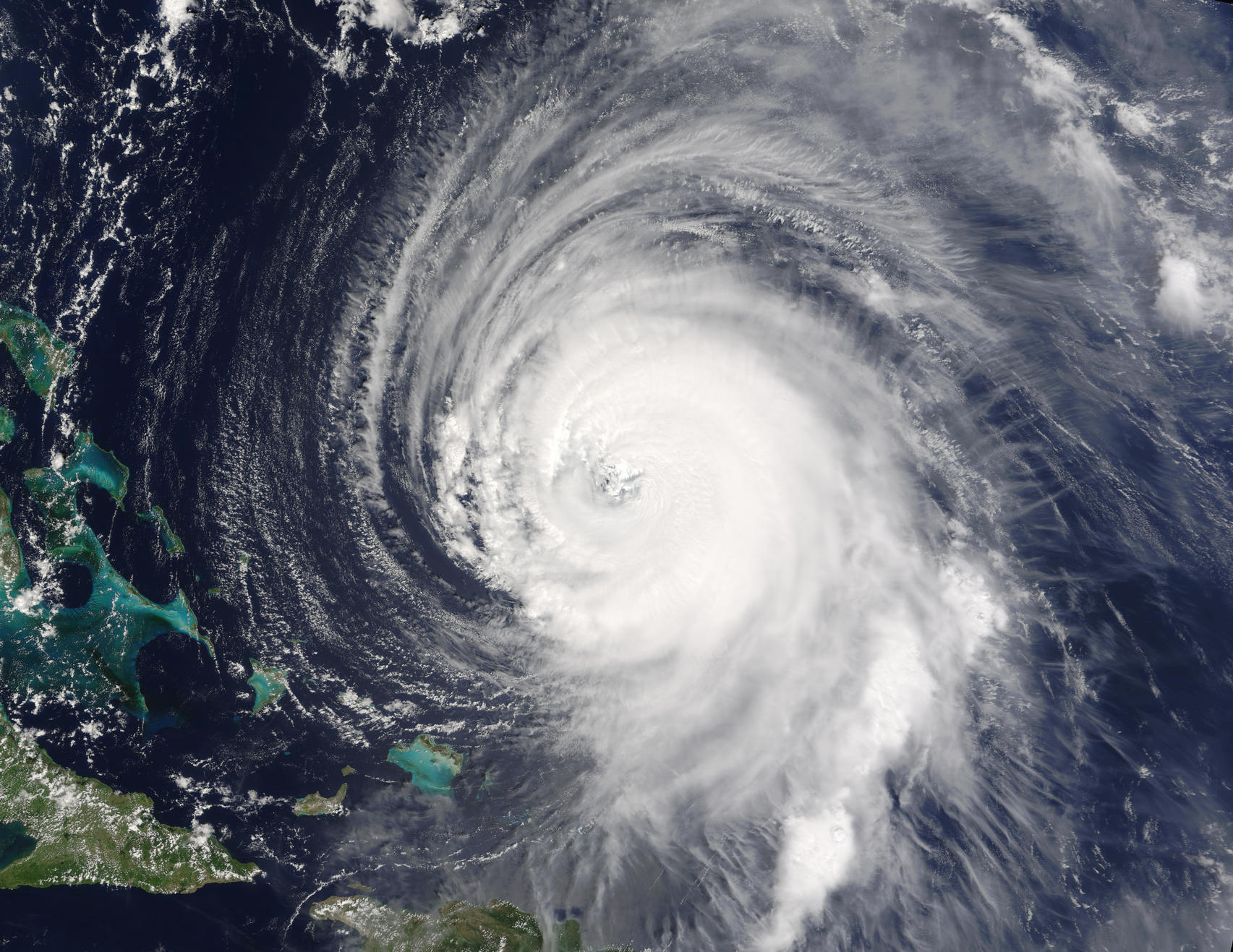
This striking image of Hurricane Isabel was provided by the polar orbiting AQUA satellite.
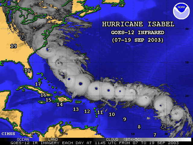
Above is a composite of several images of Hurricane Isabel over several days provided by a Geostationary satellite. Geostationary satellites are higher in the atmosphere than polar orbiting satellites so the images aren't as crisp or detailed, however, they have the advantage of being able to provide continuous images of weather systems. This is especially useful for tracking hurricanes and forcasting where they might make landfall.Continue to learn more about hurricanes